Cof Cymru: National Historic Assets of Wales · Wales
Milepost on railway bridge
Fairwater, Cardiff, Wales
A Grade II listed building in Fairwater, Cardiff, designated on 13 January 1976.
The record
- Designation
- Listed building, Grade II
- Broad class
- Transport
- Date of designation
- 13 January 1976
- Locality
- Fairwater
- Town
- Cardiff
- Community
- Fairwater
- Unitary authority
- Cardiff
- Country
- Wales
- Coordinates
- 51.48509, -3.22942
- Cadw reference
- 14085
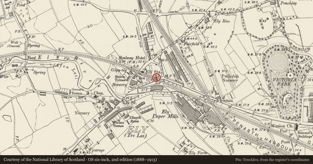
Slide toward Today to fade the historical sheet and see the modern map underneath.
David Rumsey Map Collection, Stanford LibrariesDavid Rumsey Map Collection, Stanford LibrariesDavid Rumsey Map Collection, Stanford LibrariesDavid Rumsey Map Collection, Stanford LibrariesDavid Rumsey Map Collection, Stanford Libraries
5 historical maps cover this location, the earliest the 1636 map "Cornubia : Devonia, Somersetus, Dorcestria, Wiltonia, Glocestria ..." (David Rumsey Map Collection, Stanford Libraries).
Historical maps covering this location
- 1636 · Cornubia : Devonia, Somersetus, Dorcestria, Wiltonia, Glocestria ... (David Rumsey Map Collection, Stanford Libraries)
- 1637 · The fourth table of England. Cornub. Devonia, Somerset etc. (David Rumsey Map Collection, Stanford Libraries)
- 1865 · England and Wales. England No. 6. (David Rumsey Map Collection, Stanford Libraries)
- 1898 · 263 Cardiff (Hills) (David Rumsey Map Collection, Stanford Libraries)
- 1913 · Sheet 110. Cardiff & Mouth of the Severn. (David Rumsey Map Collection, Stanford Libraries)
Cadw's description
Location
On the north side of Cowbridge Road on the railway bridge spanning the Cardiff-Swansea line.
History
Dated 1835. One of a series of mileposts on the A48 to the west of Cardiff, one of which, for Tythegston Parish, is an exhibit in the Museum of Welsh Life in St. Fagans Community (qv). See also under Cowbridge Road East and Castle Street.
Exterior
Ornately moulded cast-iron mile-post in Gothic style, one of a series on the A48 to the west of Cardiff. Rectangular panels at the base; the lower one visible 1972 and bearing the date '1835', but now hidden; the upper one inscribed 'CARDIFF DISTRICT'. Two pointed headed panels protrude from lower part of this tablet, the left hand one inscribed 'TO CARDIFF 2', and the right hand one inscribed 'TO COWBRIDGE 10'. Further inscription 'LONDON 160' below these and above rectangular panel at base inscribed 'Landaff Parish'.
Reason for designation
Included for its special historic interest as one of a series of well designed mileposts surviving on the former Cardiff-Cowbridge turnpike.
Nearby in the register
- Ely Methodist ChurchReligious, Ritual and Funeraryunder 1 mi
- Fairwater Conservative Club (Ely Rise)Institutionalunder 1 mi
- Stable Block to Fairwater Conservative Club (Ely Rise)Domesticunder 1 mi
- Garden House at Insole CourtDomesticunder 1 mi
Other entries of the same register within about three miles of this one, by straight line.