Cof Cymru: National Historic Assets of Wales · Wales
Gas Holder at British Gas Grangetown Works
Grangetown, Cardiff, Wales
A Grade II listed building in Grangetown, Cardiff, designated on 20 August 1992.
The record
- Designation
- Listed building, Grade II
- Broad class
- Industrial
- Date of designation
- 20 August 1992
- Community
- Grangetown
- Unitary authority
- Cardiff
- Country
- Wales
- Coordinates
- 51.46180, -3.19023
- Cadw reference
- 14067
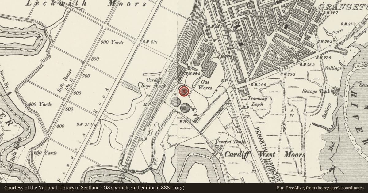
Slide toward Today to fade the historical sheet and see the modern map underneath.
David Rumsey Map Collection, Stanford LibrariesDavid Rumsey Map Collection, Stanford LibrariesDavid Rumsey Map Collection, Stanford LibrariesDavid Rumsey Map Collection, Stanford LibrariesDavid Rumsey Map Collection, Stanford Libraries
5 historical maps cover this location, the earliest the 1636 map "Cornubia : Devonia, Somersetus, Dorcestria, Wiltonia, Glocestria ..." (David Rumsey Map Collection, Stanford Libraries).
Historical maps covering this location
- 1636 · Cornubia : Devonia, Somersetus, Dorcestria, Wiltonia, Glocestria ... (David Rumsey Map Collection, Stanford Libraries)
- 1637 · The fourth table of England. Cornub. Devonia, Somerset etc. (David Rumsey Map Collection, Stanford Libraries)
- 1865 · England and Wales. England No. 6. (David Rumsey Map Collection, Stanford Libraries)
- 1898 · 263 Cardiff (Hills) (David Rumsey Map Collection, Stanford Libraries)
- 1913 · Sheet 110. Cardiff & Mouth of the Severn. (David Rumsey Map Collection, Stanford Libraries)
Cadw's description
Location
Due west of Ferry Road entrance to works, approximately 200 metres from entrance.
History
Dated 1881. Gasholder and support frame built for Cardiff Gas Light and Coke Company. Dated by inscription on plate mounted on frame, 'J & W Horton 1881 Smethwick'. Some restoration after bomb damage during Second World War.
Exterior
Shallow domed crown of holder has, at circumference, brackets with wheels running on vertical rails attached to supporting framework which consists of two tiers, each of 16 cast-iron Doric columns supporting panelled entablature blocks with cornices in the manner of Florentine C15 architecture. Upper-tier columns slightly slimmer than lower with lighter, narrower entablature blocks. Lattice girders between columns at entablature level of both tiers, and x-shaped cross-bracing between columns on both levels.
Reason for designation
Listed as striking C19 gasholder with literate architectural design to framework.
Nearby in the register
- Parish Church of St Paul.Religious, Ritual and Funeraryunder 1 mi
- Grange Farm HouseDomesticunder 1 mi
- The Wreck of the "Louisa"Boatunder 1 mi
- Former Cardiff and District Western District Sewerage Pumping Station.Water Supply and Drainageunder 1 mi
Other entries of the same register within about three miles of this one, by straight line.