Cof Cymru: National Historic Assets of Wales · Wales
Former Warehouse (The "D" Shed)
Butetown, Cardiff, Wales
A Grade II listed building in Inner Harbour Area, Butetown, Cardiff, designated on 20 August 1992.
The record
- Designation
- Listed building, Grade II
- Broad class
- Domestic
- Date of designation
- 20 August 1992
- Locality
- Inner Harbour Area
- Community
- Butetown
- Unitary authority
- Cardiff
- Country
- Wales
- Coordinates
- 51.46576, -3.16489
- Cadw reference
- 14057
Slide toward Today to fade the historical sheet and see the modern map underneath.
David Rumsey Map Collection, Stanford LibrariesDavid Rumsey Map Collection, Stanford LibrariesDavid Rumsey Map Collection, Stanford LibrariesDavid Rumsey Map Collection, Stanford LibrariesDavid Rumsey Map Collection, Stanford Libraries
5 historical maps cover this location, the earliest the 1636 map "Cornubia : Devonia, Somersetus, Dorcestria, Wiltonia, Glocestria ..." (David Rumsey Map Collection, Stanford Libraries).
Historical maps covering this location
- 1636 · Cornubia : Devonia, Somersetus, Dorcestria, Wiltonia, Glocestria ... (David Rumsey Map Collection, Stanford Libraries)
- 1865 · England and Wales. England No. 6. (David Rumsey Map Collection, Stanford Libraries)
- 1895 · Sheet 11. Ordnance Survey of England and Wales. (David Rumsey Map Collection, Stanford Libraries)
- 1898 · 263 Cardiff (Hills) (David Rumsey Map Collection, Stanford Libraries)
- 1913 · Sheet 110. Cardiff & Mouth of the Severn. (David Rumsey Map Collection, Stanford Libraries)
Cadw's description
Location
About 10m north of junction with Bute Place.
History
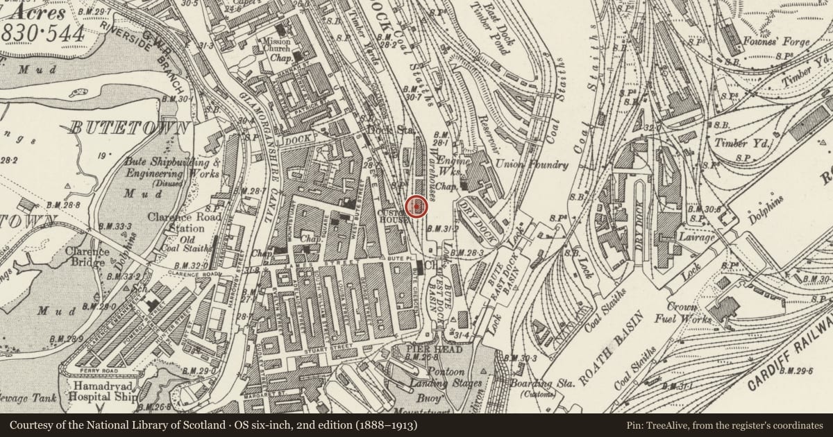
The building marked on First Edition Ordnance Survey map (surveyed 1870's) as warehouse beside Bute East Dock Basin. Known as "D" Shed, it was dismantled in the 1990s, and re-assembled on its present site in 2002.
Exterior
Northern section is mid C19 warehouse/transit shed. Slate roof. Gables in vertical boarding with blocked tripartite window. Iron frame construction of 5 bays by 2, with cruciform-sectioned Tuscan-style columns supporting I-beam entablature. Walling on west side in wooden boarding imitating the original structure of boarding with sliding doors; other sides glazed. Roof of iron construction with closely-spaced trusses; system of narrow tie bars with v-shaped cast-iron stays bolted to rafters.
Early C21 extension at S end, of triangular plan, in metal and glass, reflecting the materials of the original.
Reason for designation
Listed for special interest of C19 section of building, a rare example in Wales of a mid C19 iron framed dock warehouse/transit shed.
Nearby in the register
- Seaway HouseCommercialunder 1 mi
- 5 Dock Chambers (Emlyn House)Commercialunder 1 mi
- Former H.M.Immigration OfficeCommercialunder 1 mi
- 4 Dock Chambers (Emlyn House)Commercialunder 1 mi
Other entries of the same register within about three miles of this one, by straight line.