Cof Cymru: National Historic Assets of Wales · Wales
36 & 37
Butetown, Cardiff, Wales
A Grade II listed building in Butetown, Cardiff, designated on 20 August 1992.
The record
- Designation
- Listed building, Grade II
- Broad class
- Commercial
- Date of designation
- 20 August 1992
- Community
- Butetown
- Unitary authority
- Cardiff
- Country
- Wales
- Coordinates
- 51.46657, -3.16669
- Cadw reference
- 14023
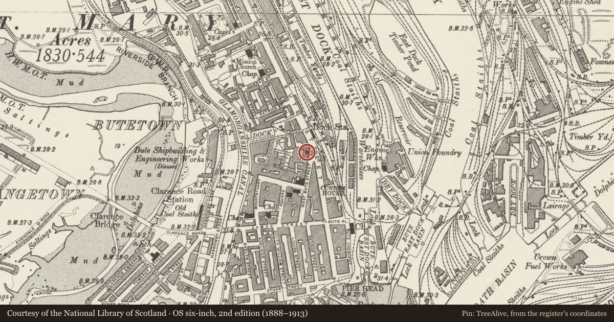
Slide toward Today to fade the historical sheet and see the modern map underneath.
David Rumsey Map Collection, Stanford LibrariesDavid Rumsey Map Collection, Stanford LibrariesDavid Rumsey Map Collection, Stanford LibrariesDavid Rumsey Map Collection, Stanford LibrariesDavid Rumsey Map Collection, Stanford Libraries
5 historical maps cover this location, the earliest the 1636 map "Cornubia : Devonia, Somersetus, Dorcestria, Wiltonia, Glocestria ..." (David Rumsey Map Collection, Stanford Libraries).
Historical maps covering this location
- 1636 · Cornubia : Devonia, Somersetus, Dorcestria, Wiltonia, Glocestria ... (David Rumsey Map Collection, Stanford Libraries)
- 1865 · England and Wales. England No. 6. (David Rumsey Map Collection, Stanford Libraries)
- 1895 · Sheet 11. Ordnance Survey of England and Wales. (David Rumsey Map Collection, Stanford Libraries)
- 1898 · 263 Cardiff (Hills) (David Rumsey Map Collection, Stanford Libraries)
- 1913 · Sheet 110. Cardiff & Mouth of the Severn. (David Rumsey Map Collection, Stanford Libraries)
Cadw's description
History
Part of a development which includes 126-132 Bute Street dating from 1850-1851, and once known as Britannia Buildings. Contractors were Hemingway and Pearson, involved in building Britannina Bridge over Menai Strait and Bute East Dock. Originally two houses.
Exterior
Stucco front, three storeys, four window bays. Projecting cornice. Second floor squarish windows with small pane hornless sashes (3 over 6), and stone sills. First floor windows with horned large pane sashes, and architraves with cornices over. Blocking course at sill level. On Ground floor, to L, deeply set entrance doorway and square headed window with architrave. Then window converted from former doorway with bracketed cornice and to R larger window with architrave.
Reason for designation
Listed as part of an early terrace on important site in Butetown and for group value with listed buildings opposite.
Nearby in the register
- 34 & 35Commercialunder 1 mi
- 33 West Bute StreetCommercialunder 1 mi
- 126 Bute StreetRecreationalunder 1 mi
- Pillar Box Outside Royal Bank of ScotlandCommunicationsunder 1 mi
Other entries of the same register within about three miles of this one, by straight line.