Cof Cymru: National Historic Assets of Wales · Wales
Bridge over Dock Feeder Canal
Butetown, Cardiff, Wales
A Grade II listed building in Junction Canal, Butetown, Cardiff, designated on 20 August 1992.
The record
- Designation
- Listed building, Grade II
- Broad class
- Transport
- Date of designation
- 20 August 1992
- Locality
- Junction Canal
- Community
- Butetown
- Unitary authority
- Cardiff
- Country
- Wales
- Coordinates
- 51.47504, -3.16931
- Cadw reference
- 13989
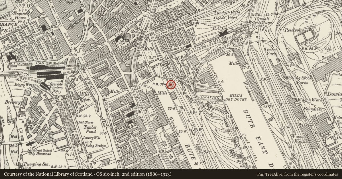
Slide toward Today to fade the historical sheet and see the modern map underneath.
David Rumsey Map Collection, Stanford LibrariesDavid Rumsey Map Collection, Stanford LibrariesDavid Rumsey Map Collection, Stanford LibrariesDavid Rumsey Map Collection, Stanford LibrariesDavid Rumsey Map Collection, Stanford Libraries
5 historical maps cover this location, the earliest the 1636 map "Cornubia : Devonia, Somersetus, Dorcestria, Wiltonia, Glocestria ..." (David Rumsey Map Collection, Stanford Libraries).
Historical maps covering this location
- 1636 · Cornubia : Devonia, Somersetus, Dorcestria, Wiltonia, Glocestria ... (David Rumsey Map Collection, Stanford Libraries)
- 1865 · England and Wales. England No. 6. (David Rumsey Map Collection, Stanford Libraries)
- 1895 · Sheet 11. Ordnance Survey of England and Wales. (David Rumsey Map Collection, Stanford Libraries)
- 1898 · 263 Cardiff (Hills) (David Rumsey Map Collection, Stanford Libraries)
- 1913 · Sheet 110. Cardiff & Mouth of the Severn. (David Rumsey Map Collection, Stanford Libraries)
Cadw's description
Location
Crosses Junction canal to E of right-angle bend.
History
Bridge probably dates from 1850's when last phase of Bute East Dock was under construction and formerly carried traffic over Junction Canal which connected Bute West and East Docks. Now footbridge in Atlantic Wharf development.
Exterior
Heavy rock-faced abutments with parapet in slightly smaller blocks. Central span of bridge set back from abutments. Smoothed-dressed band course at decking level. Rounded rock-like coping stones to span of bridge but flat coping stones to flared approaches. Canal is spanned by 4 parallel I-beams which are bound together by transverse tie rods. Flanges on I-beams support shallow brick arches on which modern brick decking is bedded.
Reason for designation
Listed as one of a pair of small bridges surviving from early period of Bute E Dock. Group value with adjacent bridge.
Nearby in the register
- Bridge over Dock Feeder CanalTransportunder 1 mi
- Marquess of Bute's WarehouseCommercialunder 1 mi
- Warehouse Adjacent to Marquess of Bute's WarehouseCommercialunder 1 mi
- Warehouse on corner of Lloyd George Avenue and Herbert StreetCommercialunder 1 mi
Other entries of the same register within about three miles of this one, by straight line.