Cof Cymru: National Historic Assets of Wales · Wales
Cast Iron Posts and Railings to E of Dock Lane
Butetown, Cardiff, Wales
A Grade II listed building in Butetown, Cardiff, designated on 20 August 1992.
The record
- Designation
- Listed building, Grade II
- Broad class
- Domestic
- Date of designation
- 20 August 1992
- Community
- Butetown
- Unitary authority
- Cardiff
- Country
- Wales
- Coordinates
- 51.46507, -3.16514
- Cadw reference
- 13985
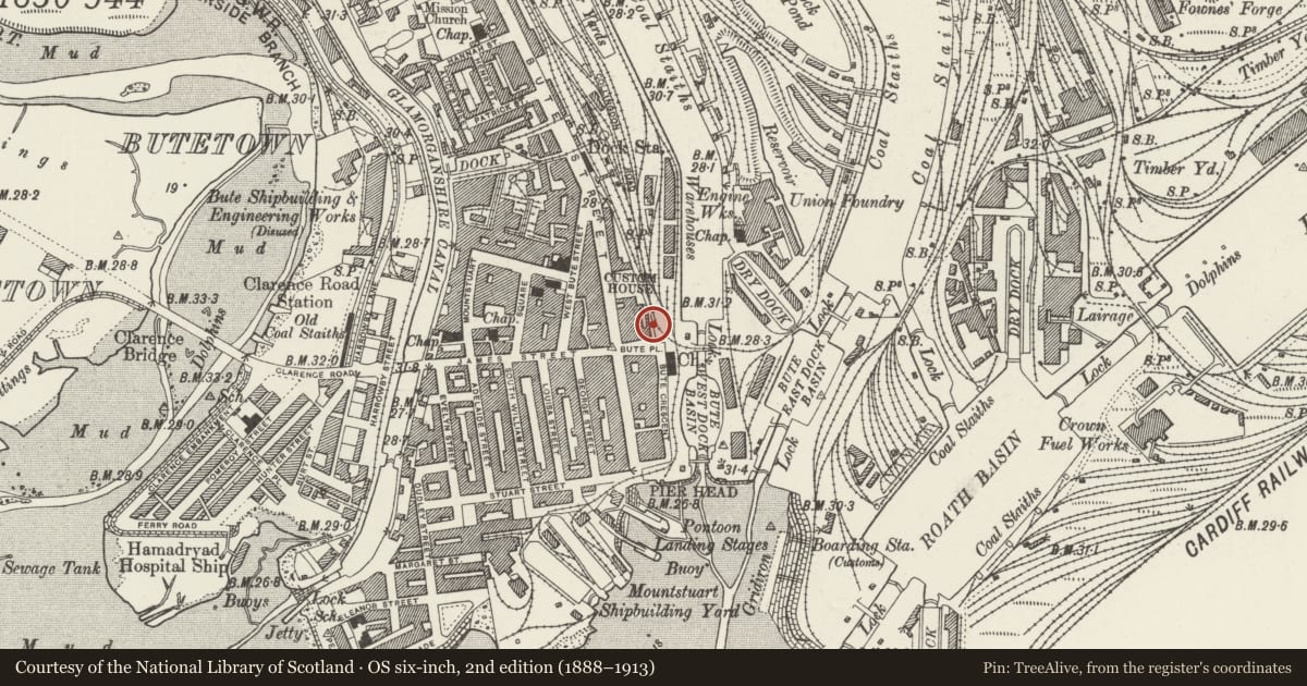
Slide toward Today to fade the historical sheet and see the modern map underneath.
David Rumsey Map Collection, Stanford LibrariesDavid Rumsey Map Collection, Stanford LibrariesDavid Rumsey Map Collection, Stanford LibrariesDavid Rumsey Map Collection, Stanford LibrariesDavid Rumsey Map Collection, Stanford Libraries
5 historical maps cover this location, the earliest the 1636 map "Cornubia : Devonia, Somersetus, Dorcestria, Wiltonia, Glocestria ..." (David Rumsey Map Collection, Stanford Libraries).
Historical maps covering this location
- 1636 · Cornubia : Devonia, Somersetus, Dorcestria, Wiltonia, Glocestria ... (David Rumsey Map Collection, Stanford Libraries)
- 1865 · England and Wales. England No. 6. (David Rumsey Map Collection, Stanford Libraries)
- 1895 · Sheet 11. Ordnance Survey of England and Wales. (David Rumsey Map Collection, Stanford Libraries)
- 1898 · 263 Cardiff (Hills) (David Rumsey Map Collection, Stanford Libraries)
- 1913 · Sheet 110. Cardiff & Mouth of the Severn. (David Rumsey Map Collection, Stanford Libraries)
Cadw's description
Location
Dock Lane is to the E of Bute Street, and runs from Pascoe House to the former Mercantile Marine Office.
Exterior
Cast iron posts and railings which were formerly the boundary to Docks area. Length of this section of railings approximately 220 metres.
Seventy four posts circa 2 metres high, round shafts with bases, cubiform plinths with 4-pointed star decoration to faces, design of plinths repeated above capitals, and hexagonal pinnacles. two modern brick piers associated with electricity supply.
Posts have inscription in raised lettering, 'Bayliss & Co, Wolverhampton'.
Between posts, simple iron railings.
Reason for designation
Listed for group value with other listed buildings in Bute Street.
Nearby in the register
- 1 Bute PlaceCommercialunder 1 mi
- 3 Bute PlaceCommercialunder 1 mi
- Former H.M.Immigration OfficeCommercialunder 1 mi
- Cory's BuildingCommercialunder 1 mi
Other entries of the same register within about three miles of this one, by straight line.