Cof Cymru: National Historic Assets of Wales · Wales
Nos 1-5 Wyndham Street (consec)
Tongwynlais, Cardiff, Wales
A Grade II listed building in Tongwynlais, Cardiff, designated on 10 June 1977.
The record
- Designation
- Listed building, Grade II
- Broad class
- Domestic
- Date of designation
- 10 June 1977
- Locality
- Tongwynlais
- Town
- Cardiff
- Community
- Tongwynlais
- Unitary authority
- Cardiff
- Country
- Wales
- Coordinates
- 51.53269, -3.25290
- Cadw reference
- 13951
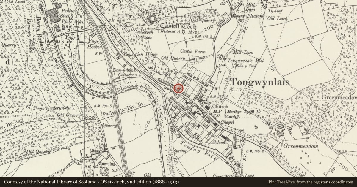
Slide toward Today to fade the historical sheet and see the modern map underneath.
David Rumsey Map Collection, Stanford LibrariesNational Library of ScotlandDavid Rumsey Map Collection, Stanford LibrariesDavid Rumsey Map Collection, Stanford LibrariesDavid Rumsey Map Collection, Stanford Libraries
5 historical maps cover this location, the earliest the 1636 map "Cornubia : Devonia, Somersetus, Dorcestria, Wiltonia, Glocestria ..." (David Rumsey Map Collection, Stanford Libraries).
Historical maps covering this location
- 1636 · Cornubia : Devonia, Somersetus, Dorcestria, Wiltonia, Glocestria ... (David Rumsey Map Collection, Stanford Libraries)
- 1637 · The fourth table of England. Cornub. Devonia, Somerset etc. (David Rumsey Map Collection, Stanford Libraries)
- 1865 · England and Wales. England No. 6. (David Rumsey Map Collection, Stanford Libraries)
- 1895 · Sheet 11. Ordnance Survey of England and Wales. (David Rumsey Map Collection, Stanford Libraries)
- 1963 · Map No. 1 - Local Government Commission for Wales : [Definitive maps showing proposed… (National Library of Scotland)
Cadw's description
Location
Towards the NW end of the village, at right angles to Merthyr Road, the main road, and the terrace Nos 4-22 Merthyr Road.
History
Probably, like the terrace in Merthyr Road, built around the middle of the C19 to serve the industrial development at Melingriffith and Pentyrch works and the through traffic on the Cardiff Merthyr highway.
Exterior
Terrace of 5 houses stepped up hillside, nos. 1-2 and 3-4 paired with doors to sides. Built of coursed snecked roughly dressed stone rubble with roughly tooled stone voussoirs and quoins and narrow painted stone sills; Welsh slate roofs with brick ridge stacks. 2 storeys, single window range and front door opening directly onto pavement. Recessed openings, some of the reveals painted; probably the houses originally had small-pane sash windows and boarded doors, all altered.
Interior
Authority Cardiff Grade II
Date Listed 10/06/1977
Community Tongwynlais Date Amended 14/11/2000
Reason for designation
Included as part of a range of mid C19 terrace housing which has group value with terrace housing and railings in Merthyr Road.
Nearby in the register
- 22 Merthyr RoadDomesticunder 1 mi
- 20 Merthyr RoadDomesticunder 1 mi
- Nos 6-8 Wyndham Street (consec)Domesticunder 1 mi
- 18 Merthyr RoadDomesticunder 1 mi
Other entries of the same register within about three miles of this one, by straight line.