Cof Cymru: National Historic Assets of Wales · Wales
Kingdom Hall of Jehovah's Witnesses
Old St. Mellons, Cardiff, Wales
A Grade II listed building in St Mellons, Cardiff, Old St. Mellons, designated on 10 June 1977.
The record
- Designation
- Listed building, Grade II
- Broad class
- Religious, Ritual and Funerary
- Date of designation
- 10 June 1977
- Locality
- St Mellons
- Town
- Cardiff
- Community
- Old St. Mellons
- Unitary authority
- Cardiff
- Country
- Wales
- Coordinates
- 51.52423, -3.11291
- Cadw reference
- 13923
Slide toward Today to fade the historical sheet and see the modern map underneath.
David Rumsey Map Collection, Stanford LibrariesDavid Rumsey Map Collection, Stanford LibrariesDavid Rumsey Map Collection, Stanford LibrariesDavid Rumsey Map Collection, Stanford LibrariesDavid Rumsey Map Collection, Stanford Libraries
5 historical maps cover this location, the earliest the 1636 map "Cornubia : Devonia, Somersetus, Dorcestria, Wiltonia, Glocestria ..." (David Rumsey Map Collection, Stanford Libraries).
Historical maps covering this location
- 1636 · Cornubia : Devonia, Somersetus, Dorcestria, Wiltonia, Glocestria ... (David Rumsey Map Collection, Stanford Libraries)
- 1865 · England and Wales. England No. 6. (David Rumsey Map Collection, Stanford Libraries)
- 1895 · Sheet 11. Ordnance Survey of England and Wales. (David Rumsey Map Collection, Stanford Libraries)
- 1898 · 263 Cardiff (Hills) (David Rumsey Map Collection, Stanford Libraries)
- 1913 · Sheet 110. Cardiff & Mouth of the Severn. (David Rumsey Map Collection, Stanford Libraries)
Cadw's description
Location
Side-on to the main thoroughfare within a small walled enclosure incorporating iron gate with heavy caps to the gate-piers.
History
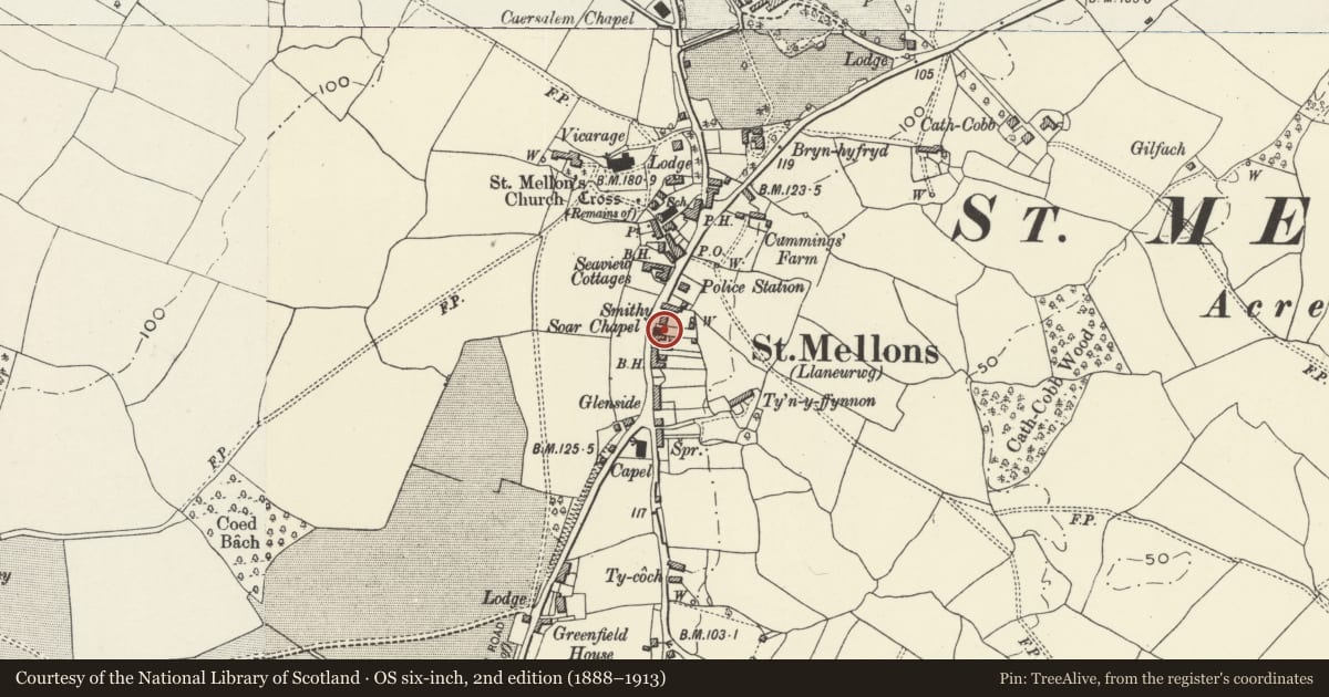
Built as Soar Welsh Independent Chapel c 1840. Shown with burial ground to rear on OS map of 1880.
Exterior
Small chapel. Of rendered stone painted in white with black detailing; shallow-pitched hipped Welsh slate roof with bracketed eaves cornice; bands at impost and sill levels to both front and side elevations. Side wall facade with 3 tall round-headed arches with shorter round-headed windows inserted within the 2 end blockings; archivolts and keystones. Small gabled porch wing against gable end also with bracketed eaves; round-headed doorway with renewed doors facing street; impost band returns to gable-end elevation curving over a now blocked window with sill. Wall extends to form a small entrance courtyard; thick rubble wall with later brick piers, pyramidal coping and iron gate with slender spear finials.
Reason for designation
Included as a small chapel in the early-mid C19 village centre of Old St Mellons; group value with the war memorial, the White Hart PH and the Bluebell Inn.
Nearby in the register
- War MemorialCommemorativeunder 1 mi
- Bethania Evangelical ChurchReligious, Ritual and Funeraryunder 1 mi
- The White Hart PHCommercialunder 1 mi
- Base of churchyard cross in St Mellons churchyardReligious, Ritual and Funeraryunder 1 mi
Other entries of the same register within about three miles of this one, by straight line.