Cof Cymru: National Historic Assets of Wales · Wales
The Unicorn Inn PH
Old St. Mellons, Cardiff, Wales
A Grade II listed building in Llanedeyrn, Cardiff, Old St. Mellons, designated on 6 October 1977.
The record
- Designation
- Listed building, Grade II
- Broad class
- Commercial
- Date of designation
- 6 October 1977
- Locality
- Llanedeyrn
- Town
- Cardiff
- Community
- Old St. Mellons
- Unitary authority
- Cardiff
- Country
- Wales
- Coordinates
- 51.53182, -3.12505
- Cadw reference
- 13869
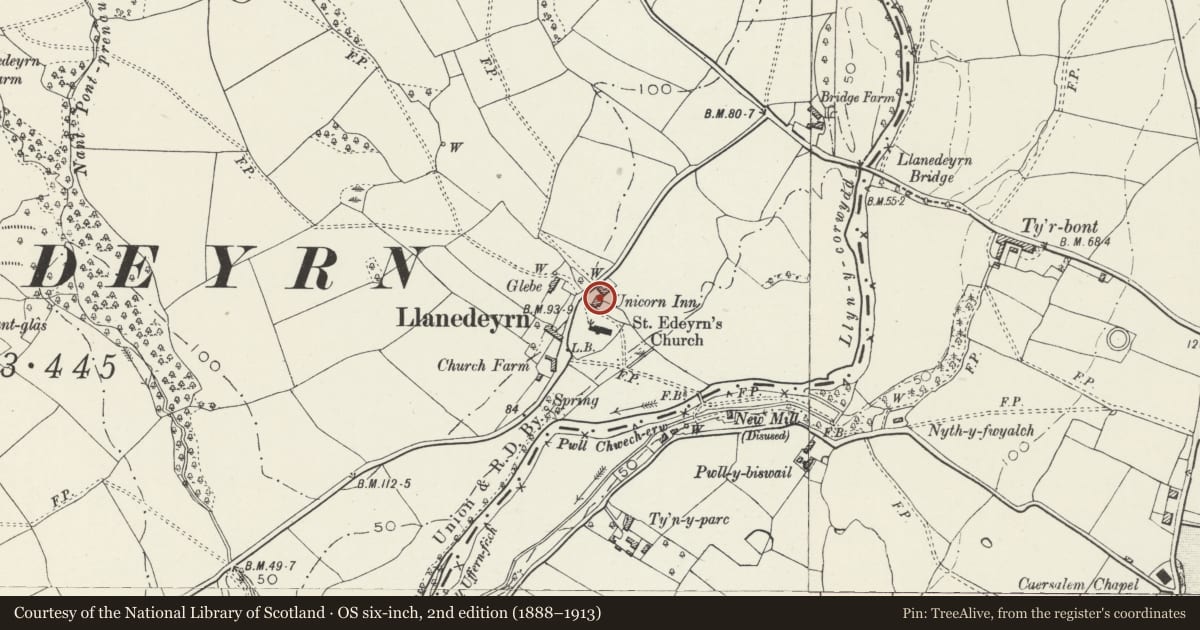
Slide toward Today to fade the historical sheet and see the modern map underneath.
David Rumsey Map Collection, Stanford LibrariesNational Library of ScotlandDavid Rumsey Map Collection, Stanford LibrariesDavid Rumsey Map Collection, Stanford LibrariesDavid Rumsey Map Collection, Stanford Libraries
5 historical maps cover this location, the earliest the 1636 map "Cornubia : Devonia, Somersetus, Dorcestria, Wiltonia, Glocestria ..." (David Rumsey Map Collection, Stanford Libraries).
Historical maps covering this location
- 1636 · Cornubia : Devonia, Somersetus, Dorcestria, Wiltonia, Glocestria ... (David Rumsey Map Collection, Stanford Libraries)
- 1637 · The fourth table of England. Cornub. Devonia, Somerset etc. (David Rumsey Map Collection, Stanford Libraries)
- 1865 · England and Wales. England No. 6. (David Rumsey Map Collection, Stanford Libraries)
- 1895 · Sheet 11. Ordnance Survey of England and Wales. (David Rumsey Map Collection, Stanford Libraries)
- 1963 · Map No. 1 - Local Government Commission for Wales : [Definitive maps showing proposed… (National Library of Scotland)
Cadw's description
Location
Close to the church, part of the still identifiable hamlet of Llanedeyrn, though near to motorway, housing and business developments.
History
Probably C17 core, the S wing. Described in late C19 as 'A comfortable old thatched house, with an inn-kitchen of the picturesque sort, open chimney, oak settle and flitches of bacon under the beams; and a native Welsh-speaking landlady'.
Exterior
Village inn. Plan of 2 units, the older wing (S) to right nearest churchyard, the left wing probably late C19. Right wing of whitewashed stone rubble with concrete tile roof and renewed brick stack, left wing in rustic style masonry with painted brick dressings and Welsh slate roof with end stack. 2 storeys. Right wing has under eaves a small 2-light casement window; on ground floor a slightly larger 2-light casement and to left a C20 lean-to porch; gable end right is incorporated in churchyard wall. Left wing has higher eaves, segmental headed tripartite window on ground floor, first floor 3-light window with black and white half timbered gable above. Adjoining at left is a single storey hipped roofed L-shaped wing of painted stone. Rear elevation has cross-wing with wide gable.
Interior
Interior of older unit retains open fireplace with stairs beside, partly remodelled, chamfered and stopped cross beams; remains of a further curved stone staircase.
Reason for designation
Included as a traditional village inn incorporating an early core which has group value with the church.
Nearby in the register
- Church of St EdeyrnReligious, Ritual and Funeraryunder 1 mi
- Farmhouse at Bridge FarmDomesticunder 1 mi
- St Julian's ManorDomesticunder 1 mi
- White Oaks (aka Rosminian Convent)Domesticunder 1 mi
Other entries of the same register within about three miles of this one, by straight line.