Cof Cymru: National Historic Assets of Wales · Wales
Bodelwyddan Castle Ice House
Bodelwyddan, Denbighshire, Wales
A Grade II* listed building in Bodelwyddan Castle, Bodelwyddan, Denbighshire, designated on 16 November 1962.
The record
- Designation
- Listed building, Grade II*
- Broad class
- Domestic
- Date of designation
- 16 November 1962
- Locality
- Bodelwyddan Castle
- Community
- Bodelwyddan
- Unitary authority
- Denbighshire
- Country
- Wales
- Coordinates
- 53.26275, -3.50357
- Cadw reference
- 1384
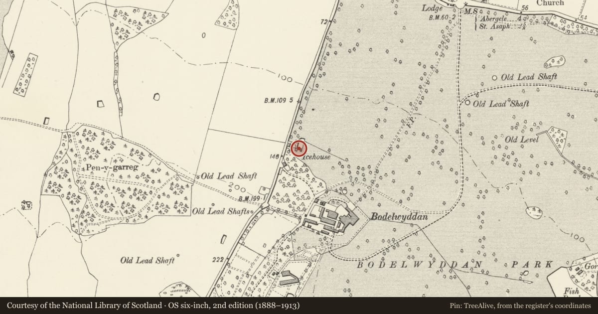
Slide toward Today to fade the historical sheet and see the modern map underneath.
David Rumsey Map Collection, Stanford LibrariesNational Library of ScotlandDavid Rumsey Map Collection, Stanford LibrariesLlyfrgell Genedlaethol Cymru – The National Library of WalesDavid Rumsey Map Collection, Stanford Libraries
5 historical maps cover this location, the earliest the 1795 map "To Sir Watkin Williams-Wynn Bart ... the map of the six counties of North Wales is most humbly inscribed by his obedient humble servant" (Llyfrgell Genedlaethol Cymru – The National Library of Wales).
Historical maps covering this location
- 1795 · To Sir Watkin Williams-Wynn Bart ... the map of the six counties of North Wales is most… (Llyfrgell Genedlaethol Cymru – The National Library of Wales)
- 1830 · V.3:11-15:XV. Britisches Reich. A. Kon: England. b. Frstenthum Wales: Shire: 37-40 (David Rumsey Map Collection, Stanford Libraries)
- 1883 · Watershed map England, Wales 3. (David Rumsey Map Collection, Stanford Libraries)
- 1901 · Sheet 9 and 10. (David Rumsey Map Collection, Stanford Libraries)
- 1963 · Map No. 36 - Local Government Commission for Wales : [Definitive maps showing proposed… (National Library of Scotland)
Cadw's description
Location
200m NW of Bodelwyddan Castle and 50m NE of Mine Cottage (in area of car parks).
History
Probably late C18; the ice-house may have been built on or near a mineshaft. There were several other lead mines in close proximity and it is conjectured that the ice house may have drained into old workings.
The ice-house is mentioned in the diary of Sir John Hay Williams in 1844, when 40 men and eight teams of horses were used to haul ice to fill it. The ice was probably brought from the pools of Felin-y-gors, at the east edge of the Park.
Exterior
Red brick circular ice-house, with dome, broken at the apex. The structure below ground is said to taper downwards. The access on the west side is ruinous.
Reason for designation
An ice house with documented history in association with a house of leading importance.
Nearby in the register
- Bodelwyddan CastleDomesticunder 1 mi
- Terrace wall of main front of Bodelwyddan Castle.No class recordedunder 1 mi
- Garden Shelter in Bodelwyddan Castle GardenNo class recordedunder 1 mi
- Play House in Bodelwyddan Castle GardenDomesticunder 1 mi
Other entries of the same register within about three miles of this one, by straight line.