Cof Cymru: National Historic Assets of Wales · Wales
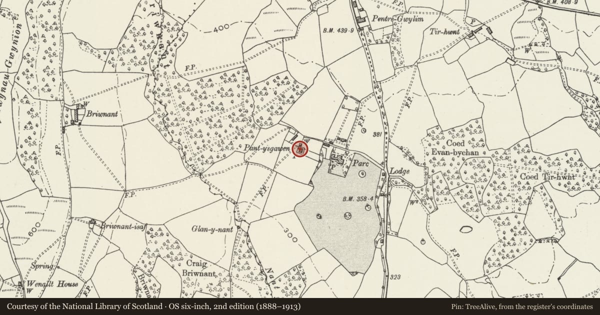
Pantysgawen
Rhiwbina, Cardiff, Wales
A Grade II listed building in Thornhill, Cardiff, Rhiwbina, designated on 19 May 1975.
The record
- Designation
- Listed building, Grade II
- Broad class
- Domestic
- Date of designation
- 19 May 1975
- Locality
- Thornhill
- Town
- Cardiff
- Community
- Rhiwbina
- Unitary authority
- Cardiff
- Country
- Wales
- Coordinates
- 51.54323, -3.21023
- Cadw reference
- 13810
Slide toward Today to fade the historical sheet and see the modern map underneath.
David Rumsey Map Collection, Stanford LibrariesDavid Rumsey Map Collection, Stanford LibrariesDavid Rumsey Map Collection, Stanford LibrariesDavid Rumsey Map Collection, Stanford LibrariesDavid Rumsey Map Collection, Stanford Libraries
5 historical maps cover this location, the earliest the 1636 map "Cornubia : Devonia, Somersetus, Dorcestria, Wiltonia, Glocestria ..." (David Rumsey Map Collection, Stanford Libraries).
Historical maps covering this location
- 1636 · Cornubia : Devonia, Somersetus, Dorcestria, Wiltonia, Glocestria ... (David Rumsey Map Collection, Stanford Libraries)
- 1865 · England and Wales. England No. 6. (David Rumsey Map Collection, Stanford Libraries)
- 1895 · Sheet 11. Ordnance Survey of England and Wales. (David Rumsey Map Collection, Stanford Libraries)
- 1906 · 249 Newport (Hills) (David Rumsey Map Collection, Stanford Libraries)
- 1913 · Sheet 102. Newport. (David Rumsey Map Collection, Stanford Libraries)
Cadw's description
Location
Situated on the lower slopes of Caerphilly mountain, just above the M4 and reached by a farm track behind Manor Park Hotel.
History
Probably C17. Much altered since RCAHMW survey when it apparently retained timber partition and thatched roof amongst other features.
Exterior
Small farmhouse. C17 to C18. One storey and attic. Thick walls of stone rubble, white painted, boulder footings; artificial slate roof incorporating rooflight with 2 full dormers with stone sills; brick end stack. Ground floor has 3 windows with concrete sills, incomplete hoodmould to right, centre right doorway; all plastic glazing. In N gable end is the curved wall of bread oven. Substantially extended to rear.
Interior
Since listing interior has reportedly been converted into single living room; open fireplace and chamfered and stopped cross beams and spiral stairs beside fireplace retained.
Reason for designation
Retained on list notwithstanding considerable alteration since listing as retaining a proportion of historic fabric.
Nearby in the register
- Briwnant Farmhouse and adjoining farm rangeDomesticunder 1 mi
- The Long Barn and attached courtyard wall, gates and railingsDomesticunder 1 mi
- New House HotelDomesticunder 1 mi
- Fynnon Wen Public HouseDomesticunder 1 mi
Other entries of the same register within about three miles of this one, by straight line.