Cof Cymru: National Historic Assets of Wales · Wales
Fferm Farmhouse
Bodelwyddan, Denbighshire, Wales
A Grade II listed building in Fferm, Bodelwyddan, Denbighshire, designated on 16 November 1962.
The record
- Designation
- Listed building, Grade II
- Broad class
- Domestic
- Date of designation
- 16 November 1962
- Locality
- Fferm
- Community
- Bodelwyddan
- Unitary authority
- Denbighshire
- Country
- Wales
- Coordinates
- 53.28053, -3.48279
- Cadw reference
- 1380
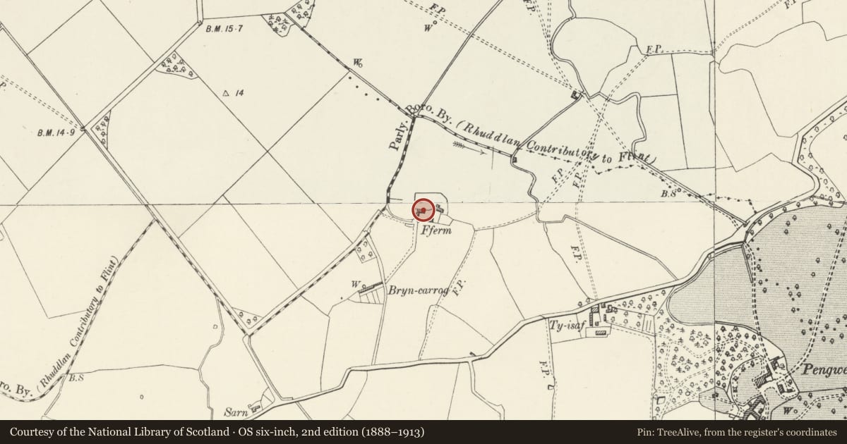
Slide toward Today to fade the historical sheet and see the modern map underneath.
David Rumsey Map Collection, Stanford LibrariesDavid Rumsey Map Collection, Stanford LibrariesNational Library of ScotlandDavid Rumsey Map Collection, Stanford LibrariesLlyfrgell Genedlaethol Cymru – The National Library of Wales
5 historical maps cover this location, the earliest the 1795 map "To Sir Watkin Williams-Wynn Bart ... the map of the six counties of North Wales is most humbly inscribed by his obedient humble servant" (Llyfrgell Genedlaethol Cymru – The National Library of Wales).
Historical maps covering this location
- 1795 · To Sir Watkin Williams-Wynn Bart ... the map of the six counties of North Wales is most… (Llyfrgell Genedlaethol Cymru – The National Library of Wales)
- 1883 · Watershed map England, Wales 3. (David Rumsey Map Collection, Stanford Libraries)
- 1898 · 95 Rhyl (Hills) (David Rumsey Map Collection, Stanford Libraries)
- 1901 · Sheet 9 and 10. (David Rumsey Map Collection, Stanford Libraries)
- 1963 · Map No. 36 - Local Government Commission for Wales : [Definitive maps showing proposed… (National Library of Scotland)
Cadw's description
Location
200m NW of the Bodelwyddan to Rhuddlan road.
History
The earliest part of the house is dated on an internal beam, 1593. Of this date, there is a single unit only, suggesting either that the farm was not originally a full dwelling, or that its earlier continuation has been lost. Added to this original unit, a narrow heated unit of apparently C19 character has been largely rebuilt, and an early twentieth century remodelling of an earlier single storey bay beyond was also rebuilt and heavily extended in 1993.
Exterior
The original section of the house comprises a 2 storey, 2-window range; limestone rubble, heavily rendered, with old slate roof and gable end stack. South-facing front elevation formerly had central doorway (now a window), and 2 windows on each floor; prior to c1990, these were small-paned horizontally sliding sashes to the first floor, and small-paned sashes below. All have now been renewed as casements with minimal glazing bars. Small window alongside chimney in east gable end. West of this range comprises either late C20 reconstruction or extension, also rendered and with slate roofs, but otherwise with modern detail.
Interior
The original section of the house comprises a single large room with massive fireplace with cambered bressumer at gable end. Heavy chamfered lateral beams (including one against the wall away from the fireplace), and chamfered joists. Beam next to the fireplace bears inscription in raised letters ''''Anno Domini 1593. 5555'''', the latter thought to be an anno mundi date. One beam has slots for a former partition, but perhaps for a secondary sub-division. Evidence for a doorway alongside the chimney was discovered during building work. The staircase mentioned in earlier descriptions was in the SW angle of the main room, but was removed c1993. Upstairs, a single roof truss has been exposed: its original form was a tie-beam truss with raking struts and collar, but at some time, the tie-beam was cut-through, and one of the struts replaced: evidence also that the building has been raised in height.
Reason for designation
Listed notwithstanding major extension and alteration, as retaining at its core the substantial remains of a late C16 house, of which good interior features survive.
Nearby in the register
- Pengwern Hall (Pengwern College)Domesticunder 1 mi
- Garden Cottage at Pengwern HallDomesticunder 1 mi
- Woodwork Block (former Coach House) at Pengwern HallDomesticunder 1 mi
- Coach House at Pengwern Hall with Outbuildings Range to WDomesticunder 1 mi
Other entries of the same register within about three miles of this one, by straight line.