Cof Cymru: National Historic Assets of Wales · Wales
Church of St David
Painscastle, Powys, Wales
A Grade II listed building in Llandewi Fach, Painscastle, Powys, designated on 9 March 1995.
The record
- Designation
- Listed building, Grade II
- Broad class
- Religious, Ritual and Funerary
- Date of designation
- 9 March 1995
- Locality
- Llandewi Fach
- Community
- Painscastle
- Unitary authority
- Powys
- Country
- Wales
- Coordinates
- 52.10054, -3.24789
- Cadw reference
- 1372
Slide toward Today to fade the historical sheet and see the modern map underneath.
David Rumsey Map Collection, Stanford LibrariesDavid Rumsey Map Collection, Stanford LibrariesDavid Rumsey Map Collection, Stanford LibrariesDavid Rumsey Map Collection, Stanford LibrariesDavid Rumsey Map Collection, Stanford Libraries
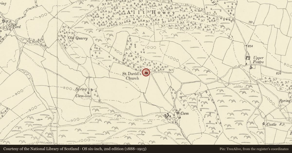
5 historical maps cover this location, the earliest the 1608 map "(13) Cambriae Typus." (David Rumsey Map Collection, Stanford Libraries).
Historical maps covering this location
- 1608 · (13) Cambriae Typus. (David Rumsey Map Collection, Stanford Libraries)
- 1636 · Cornubia : Devonia, Somersetus, Dorcestria, Wiltonia, Glocestria ... (David Rumsey Map Collection, Stanford Libraries)
- 1637 · Particular description of Wales. Cambria seu Wallia (David Rumsey Map Collection, Stanford Libraries)
- 1898 · 197 Hay (Hills) (David Rumsey Map Collection, Stanford Libraries)
- 1901 · Sheet 14. (David Rumsey Map Collection, Stanford Libraries)
Cadw's description
Location
Isolated position 3.2 kilometres south west of Painscastle, reached along pathway from Cwm.
Exterior
Rebuilding on ancient site by Pritchard and Seddon 1857-1860. Small nave, chancel, south porch, louvred bellcote with pyramid roof. Rubble stone, clasping diagonal set buttresses, artificial slate roof. South wall of nave has unusual two-light windows in C14 bar tracery style with cusped heads and glazed lunette.
Very small churchyard with numerous tombstones and yew trees. Inscribed grave slab of 1691 by south east corner of porch.
Interior
Fireplace in north wall, flagstone floor, tall pointed chancel arch, boarded ceiling, re-used dado panelling, turned communion rails dated 1712, octagonal font, two simple C17 wood benches with scribed mouldings.
Reason for designation
Included as a well-designed small country church by an eminent firm of Victorian architects; outstanding hillside setting.
Nearby in the register
- U-Plan Outbuilding Range to W of Cwm FarmhouseAgriculture and Subsistenceunder 1 mi
- Cwm FarmhouseDomesticunder 1 mi
- Begwns standing stoneStanding Stoneunder 1 mi
- LllanbachoweyDomesticunder 1 mi
Other entries of the same register within about three miles of this one, by straight line.