Cof Cymru: National Historic Assets of Wales · Wales
Bedwas Balti Restaurant, The Indian Cottage and Bridge Cottage
Bedwas, Trethomas and Machen, Caerphilly, Wales
A Grade II listed building in Bedwas, Bedwas, Trethomas and Machen, Caerphilly, designated on 24 January 1978.
The record
- Designation
- Listed building, Grade II
- Broad class
- Domestic
- Date of designation
- 24 January 1978
- Locality
- Bedwas
- Community
- Bedwas, Trethomas and Machen
- Unitary authority
- Caerphilly
- Country
- Wales
- Coordinates
- 51.58966, -3.19933
- Cadw reference
- 13563
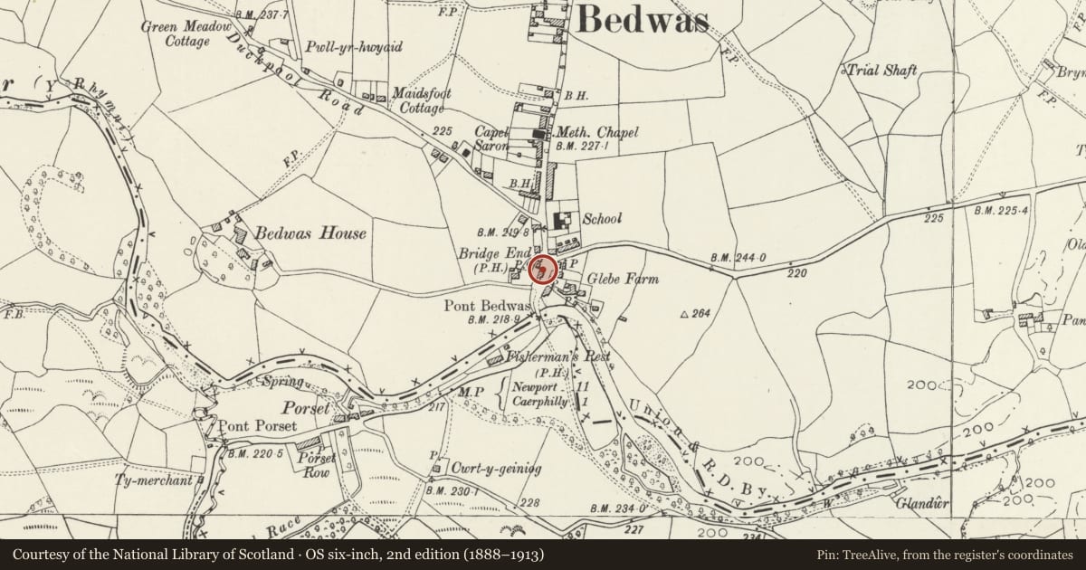
Slide toward Today to fade the historical sheet and see the modern map underneath.
David Rumsey Map Collection, Stanford LibrariesDavid Rumsey Map Collection, Stanford LibrariesDavid Rumsey Map Collection, Stanford LibrariesDavid Rumsey Map Collection, Stanford LibrariesDavid Rumsey Map Collection, Stanford Libraries
5 historical maps cover this location, the earliest the 1636 map "Cornubia : Devonia, Somersetus, Dorcestria, Wiltonia, Glocestria ..." (David Rumsey Map Collection, Stanford Libraries).
Historical maps covering this location
- 1636 · Cornubia : Devonia, Somersetus, Dorcestria, Wiltonia, Glocestria ... (David Rumsey Map Collection, Stanford Libraries)
- 1865 · England and Wales. England No. 6. (David Rumsey Map Collection, Stanford Libraries)
- 1895 · Sheet 11. Ordnance Survey of England and Wales. (David Rumsey Map Collection, Stanford Libraries)
- 1906 · 249 Newport (Hills) (David Rumsey Map Collection, Stanford Libraries)
- 1913 · Sheet 102. Newport. (David Rumsey Map Collection, Stanford Libraries)
Cadw's description
Location
Set at an angle on W side of junction with modern dual carriageway (A468).
History
Vernacular structure of domestic type dating from later C17 to mid C18 with later C19 front wing. Modern alterations. Shown on 1841 Tithe Map without gabled front wing. The property then belonged to John Homfrey Esq of Bedwas House.
Exterior
Vernacular house of three distinct portions. Two-storey whitewashed range to left with later C19 rubble, gabled wing forward to centre and one-storey plus attic range to right. Main portion of building has shaped slate tiles (formerly stone slates), slated roof to N with single swept dormer-head; four rendered stacks with wide drip-courses. Shortened gable end to S with projecting chimney breast and small 2-light upper window to right. Main front range has paired upper casement windows rising through eaves and with broad sills. Ground floor doorway to lower left with 4-panel door behind metal grille. Projecting front wing has rubble quoins and a plain tripartite timber window over symmetrical shop front with centre door under overall fascia. N range has casements to single dormer and modern ground-floor openings. Stone-walled forecourt plus yard to rear.
Interior
Not inspected (Dec 1998) but interior said to retain thick dividing wall with stopped and chamfered beam and bread ovens at NE end, stone-flagged floor.
Reason for designation
A vernacular dwelling of several periods and with interesting regional character. Prominent location on entry to Bedwas village.
Nearby in the register
- Pont Bedwas (partly in Bedwas, Trethomas and Machen community)Transportunder 1 mi
- Pont Bedwas (partly in Van community)Transportunder 1 mi
- The White Hart InnRecreationalunder 1 mi
- War MemorialReligious, Ritual and Funeraryunder 1 mi
Other entries of the same register within about three miles of this one, by straight line.