Cof Cymru: National Historic Assets of Wales · Wales
30 Graig-yr-Helfa Road
Pontypridd, Rhondda Cynon Taff, Wales
A Grade II listed building in Glyntaff, Pontypridd, Rhondda Cynon Taff, designated on 25 May 1962.
The record
- Designation
- Listed building, Grade II
- Broad class
- Domestic
- Date of designation
- 25 May 1962
- Locality
- Glyntaff
- Community
- Pontypridd
- Unitary authority
- Rhondda Cynon Taff
- Country
- Wales
- Coordinates
- 51.59832, -3.32358
- Cadw reference
- 13491
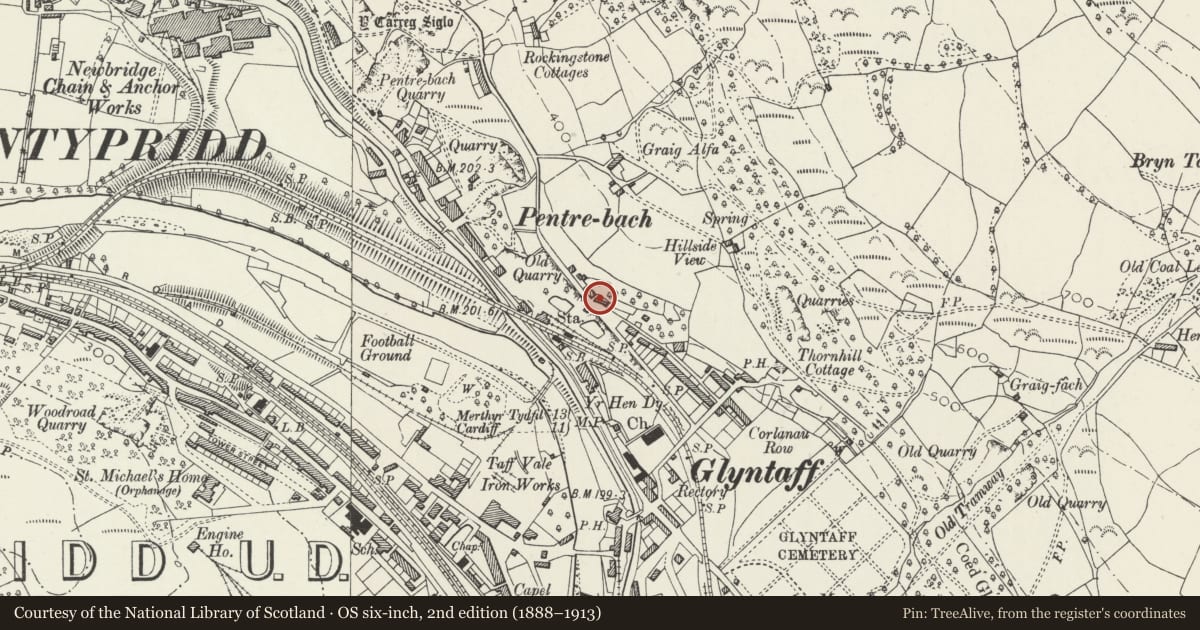
Slide toward Today to fade the historical sheet and see the modern map underneath.
David Rumsey Map Collection, Stanford LibrariesDavid Rumsey Map Collection, Stanford LibrariesDavid Rumsey Map Collection, Stanford LibrariesDavid Rumsey Map Collection, Stanford LibrariesDavid Rumsey Map Collection, Stanford Libraries
5 historical maps cover this location, the earliest the 1636 map "Cornubia : Devonia, Somersetus, Dorcestria, Wiltonia, Glocestria ..." (David Rumsey Map Collection, Stanford Libraries).
Historical maps covering this location
- 1636 · Cornubia : Devonia, Somersetus, Dorcestria, Wiltonia, Glocestria ... (David Rumsey Map Collection, Stanford Libraries)
- 1637 · The fourth table of England. Cornub. Devonia, Somerset etc. (David Rumsey Map Collection, Stanford Libraries)
- 1865 · England and Wales. England No. 6. (David Rumsey Map Collection, Stanford Libraries)
- 1906 · 249 Newport (Hills) (David Rumsey Map Collection, Stanford Libraries)
- 1913 · Sheet 102. Newport. (David Rumsey Map Collection, Stanford Libraries)
Cadw's description
Location
On a W-facing hillside overlooking the town. No 30 incorporates the southernmost of the towers.
History
Built in 1838-9 by Dr William Price in connection with a 'Druidic museum' close to the Rocking Stone on Pontypridd Common. The 'museum' was a 4-storey round house demolished c1950.
Willian Price (1800-93) was a doctor, chartist and druid who performed druidical rites at the nearby rocking stone and was a conspicuous local figure dressed in white tunic, scarlet waistcoat, green trousers and fox-skin hat. He achieved a national reputation as an advocate of free love and vegetarianism and scorned orthodox religion and society. His acquittal in 1884 on charges of illegally cremating his son established the legality of cremation in British law.
Exterior
Belongs to a group of 4.
Group: 29-32 Graig-yr-Helfa Road, Glyntaff, Pontypridd
Comprising a pair of 3-stage round towers flanking wrought iron gates and with 2-storey attached wings. Of rendered walls painted white. The towers and the attached wing on the R side have slate roofs, the wing on the L side has replaced tile roofs, all with wide boarded eaves. The towers have eaves stacks to the outer sides, the wings each have 2 ridge stacks. In the lower and middle stage the towers have 3 narrow windows with triangular heads, while the upper stage has 2 windows. The rear wings each incorporate single-fronted and then double cottages. Added lower projections are at each ends and at the rear.
Interior
The interiors are modernised.
Reason for designation
Listed, notwithstanding extensive alterations, for its architectural interest as part of a striking group in a commanding position above the town, and for its association with Dr William Price, pioneer of the Celtic Revival of the C19.
Nearby in the register
- 29 Graig-yr-Helfa RoadDomesticunder 1 mi
- Glyntaff Round HouseDomesticunder 1 mi
- 32 Graig-yr-Helfa RoadDomesticunder 1 mi
- Church of St MaryReligious, Ritual and Funeraryunder 1 mi
Other entries of the same register within about three miles of this one, by straight line.