Cof Cymru: National Historic Assets of Wales · Wales
Bridge on main drive to Hensol Castle
Pendoylan, Vale of Glamorgan, Wales
A Grade II listed building in Hensol, Pendoylan, Vale of Glamorgan, designated on 5 February 1993.
The record
- Designation
- Listed building, Grade II
- Broad class
- Health and Welfare
- Date of designation
- 5 February 1993
- Locality
- Hensol
- Community
- Pendoylan
- Unitary authority
- Vale of Glamorgan
- Country
- Wales
- Coordinates
- 51.50391, -3.36988
- Cadw reference
- 13483
Slide toward Today to fade the historical sheet and see the modern map underneath.
David Rumsey Map Collection, Stanford LibrariesDavid Rumsey Map Collection, Stanford LibrariesDavid Rumsey Map Collection, Stanford LibrariesDavid Rumsey Map Collection, Stanford LibrariesDavid Rumsey Map Collection, Stanford Libraries
5 historical maps cover this location, the earliest the 1636 map "Cornubia : Devonia, Somersetus, Dorcestria, Wiltonia, Glocestria ..." (David Rumsey Map Collection, Stanford Libraries).
Historical maps covering this location
- 1636 · Cornubia : Devonia, Somersetus, Dorcestria, Wiltonia, Glocestria ... (David Rumsey Map Collection, Stanford Libraries)
- 1637 · The fourth table of England. Cornub. Devonia, Somerset etc. (David Rumsey Map Collection, Stanford Libraries)
- 1865 · England and Wales. England No. 6. (David Rumsey Map Collection, Stanford Libraries)
- 1895 · Sheet 11. Ordnance Survey of England and Wales. (David Rumsey Map Collection, Stanford Libraries)
- 1897 · 262 Pontypridd (Hills) (David Rumsey Map Collection, Stanford Libraries)
Cadw's description
Location
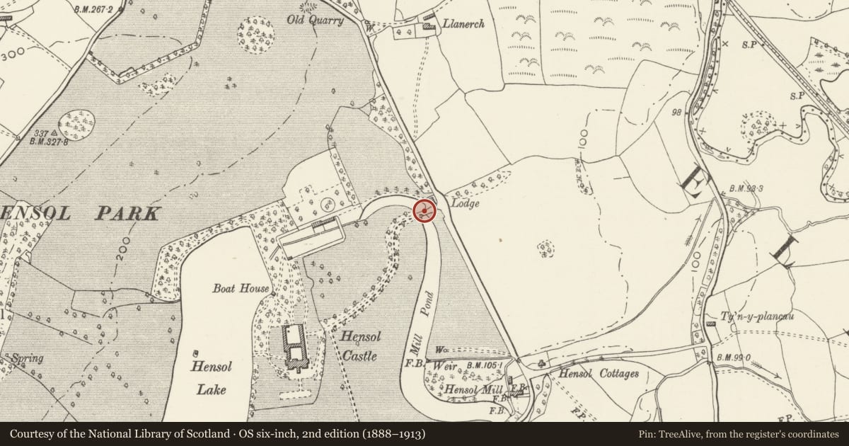
Near the bottom of the main (East) drive close to Hafod Lodge; spans the Mill Pond which runs off Hensol lake. Hensol Castle is set within a landscaped park near Pendoylan, approximately 2km from the M4 motorway.
History
Probably contemporary with the 1840s enlargement and remodelling of Hensol Castle which was carried out by T. H. Wyatt and D. Brandon, architects of London for the industrialist Rowland Fothergill, who bought the estate in 1838. Some modern alterations and recent deterioration at the west end.
Hensol castle has late C17 / early C18 origins, was fully remodelled circa 1735 by the Talbot family and after 1782 it was greatly extended in a castellated manner before undergoing the major remodelling in 1840s. Since 1927 it was in use as a county mental hospital and is now a conference centre.
Exterior
Broad and ramped 4-arch stone bridge of coursed rubble construction with part-balustraded parapets. This unusual, even number, gives the bridge an ornamental character which is strengthened by the deliberately over-size nature of these arches, suggesting a major river rather than a slow leet to a mill; voussoirs retained but arches infilled with water directed through a pipe. balustraded parapet to centre is partly rebuilt in cement; closed parapet to ends with freestone chamfered piers. Gothic flying buttresses at main entrance adjoining sweeping boundary wall.
Reason for designation
Included for group value with Hafod Lodge and Hensol Castle.
Nearby in the register
- Hafod Lodge to Hensol Castle (Also known as Bottom Lodge)Health and Welfareunder 1 mi
- Hensol Castle (Including attached Courtyard Ranges to N)Health and Welfareunder 1 mi
- Caer GwanafEnclosureunder 1 mi
- Felin Isaf Castle MoundMotteunder 1 mi
Other entries of the same register within about three miles of this one, by straight line.