Cof Cymru: National Historic Assets of Wales · Wales
Lodge to Friars Point House
Barry, Vale of Glamorgan, Wales
A Grade II listed building in Barry Island, Barry, Vale of Glamorgan, designated on 30 July 1991.
The record
- Designation
- Listed building, Grade II
- Broad class
- Domestic
- Date of designation
- 30 July 1991
- Locality
- Barry Island
- Community
- Barry
- Unitary authority
- Vale of Glamorgan
- Country
- Wales
- Coordinates
- 51.39025, -3.27908
- Cadw reference
- 13457
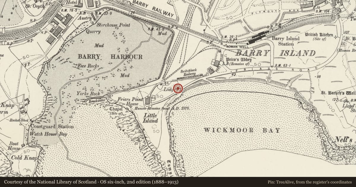
Slide toward Today to fade the historical sheet and see the modern map underneath.
David Rumsey Map Collection, Stanford LibrariesDavid Rumsey Map Collection, Stanford LibrariesDavid Rumsey Map Collection, Stanford LibrariesDavid Rumsey Map Collection, Stanford LibrariesDavid Rumsey Map Collection, Stanford Libraries
5 historical maps cover this location, the earliest the 1636 map "Cornubia : Devonia, Somersetus, Dorcestria, Wiltonia, Glocestria ..." (David Rumsey Map Collection, Stanford Libraries).
Historical maps covering this location
- 1636 · Cornubia : Devonia, Somersetus, Dorcestria, Wiltonia, Glocestria ... (David Rumsey Map Collection, Stanford Libraries)
- 1858 · 20. Bridgewater. (David Rumsey Map Collection, Stanford Libraries)
- 1865 · England and Wales. England No. 6. (David Rumsey Map Collection, Stanford Libraries)
- 1898 · 263 Cardiff (Hills) (David Rumsey Map Collection, Stanford Libraries)
- 1913 · Sheet 110. Cardiff & Mouth of the Severn. (David Rumsey Map Collection, Stanford Libraries)
Cadw's description
Location
On the R of the gated entrance to the tree-lined drive of Friars Point House which lies in its own grounds at the W end of Barry Island.
History
1890's lodge, not on the 1st Ed OS Map but shown on 2nd Ed OS Map, surveyed in 1898: Probably erected by Lord Windsor at the time when he laid out the grounds and carried out alterations to Friars Point House.
Exterior
Single-storey lodge with pebbledash elevations, painted quoins and rubble plinth. Hipped slate roof to centre with broad gable ended bay forward to front and raised gable to right hand side; wide boarded eaves, unfilled above collar level on the gables; square chimney to rear. Bay window to front with tripartite horned sash glazing. Open sided porch to RH corner with balustraded band over cusped arched front and side openings; turned columns retained abutting the house and renewed free-standing column to the corner.
Reason for designation
Included for group value with Friars Point House and the Gates and Gate piers at the drive entrance.
Nearby in the register
- Gates and Gatepiers at drive entrance to Friars Point HouseDomesticunder 1 mi
- West Shelter and Amusement ArcadeNo class recordedunder 1 mi
- Friars Point HouseDomesticunder 1 mi
- Seafront WallNo class recordedunder 1 mi
Other entries of the same register within about three miles of this one, by straight line.