Cof Cymru: National Historic Assets of Wales · Wales
Downs Farmhouse
Dinas Powys, Vale of Glamorgan, Wales
A Grade II listed building in Dinas Powys, Vale of Glamorgan, designated on 13 May 1975.
The record
- Designation
- Listed building, Grade II
- Broad class
- Domestic
- Date of designation
- 13 May 1975
- Community
- Dinas Powys
- Unitary authority
- Vale of Glamorgan
- Country
- Wales
- Coordinates
- 51.41980, -3.20158
- Cadw reference
- 13392
Slide toward Today to fade the historical sheet and see the modern map underneath.
David Rumsey Map Collection, Stanford LibrariesDavid Rumsey Map Collection, Stanford LibrariesDavid Rumsey Map Collection, Stanford LibrariesDavid Rumsey Map Collection, Stanford LibrariesDavid Rumsey Map Collection, Stanford Libraries
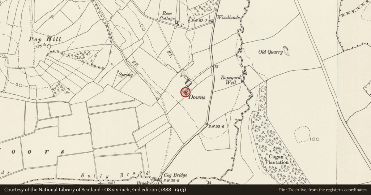
5 historical maps cover this location, the earliest the 1636 map "Cornubia : Devonia, Somersetus, Dorcestria, Wiltonia, Glocestria ..." (David Rumsey Map Collection, Stanford Libraries).
Historical maps covering this location
- 1636 · Cornubia : Devonia, Somersetus, Dorcestria, Wiltonia, Glocestria ... (David Rumsey Map Collection, Stanford Libraries)
- 1637 · The fourth table of England. Cornub. Devonia, Somerset etc. (David Rumsey Map Collection, Stanford Libraries)
- 1865 · England and Wales. England No. 6. (David Rumsey Map Collection, Stanford Libraries)
- 1898 · 263 Cardiff (Hills) (David Rumsey Map Collection, Stanford Libraries)
- 1913 · Sheet 110. Cardiff & Mouth of the Severn. (David Rumsey Map Collection, Stanford Libraries)
Cadw's description
Location
SE of the main village on the edge of the low-lying land known as the Moors, reached by a drive.
History
Probably late C17. Shown on Tithe Map 1840 as L-shaped, called The Downs
Exterior
Large farmhouse. Walls of rendered stone; slate roof with end and ridge stacks. 2 storeys and attic. Plan of lobby entry onto central back to back fireplace dividing hall and parlour. Symmetrical frontage. Narrow central entrance bay breaks forward, the roof extending over; front door with rectangular window over. Two window range each side, all decorative C20 glazing to casements.
Interior
Interior retains original layout, open fireplaces back to back. Reportedly retains broad chamfered beams with ovolo stops and one fireplace bressumer with sunk chamfer.
Reason for designation
Listed as a large symmetrical C17 farmhouse of relatively unusual plan retaining much of its historic fabric.
Nearby in the register
- Eight rickstands to N side of Cog FarmAgriculture and Subsistenceunder 1 mi
- Cogan Deserted Medieval VillageDeserted Medieval Villageunder 1 mi
- Planned group of farmyard buildings at Cog FarmAgriculture and Subsistenceunder 1 mi
- Barn at Home FarmAgriculture and Subsistenceunder 1 mi
Other entries of the same register within about three miles of this one, by straight line.