Cof Cymru: National Historic Assets of Wales · Wales
N.Lodge to Windsor Gardens (Piermaster's Lodge)
Penarth, Vale of Glamorgan, Wales
A Grade II listed building in Penarth, Vale of Glamorgan, designated on 21 January 1993.
The record
- Designation
- Listed building, Grade II
- Broad class
- Domestic
- Date of designation
- 21 January 1993
- Community
- Penarth
- Unitary authority
- Vale of Glamorgan
- Country
- Wales
- Coordinates
- 51.43516, -3.16805
- Cadw reference
- 13345
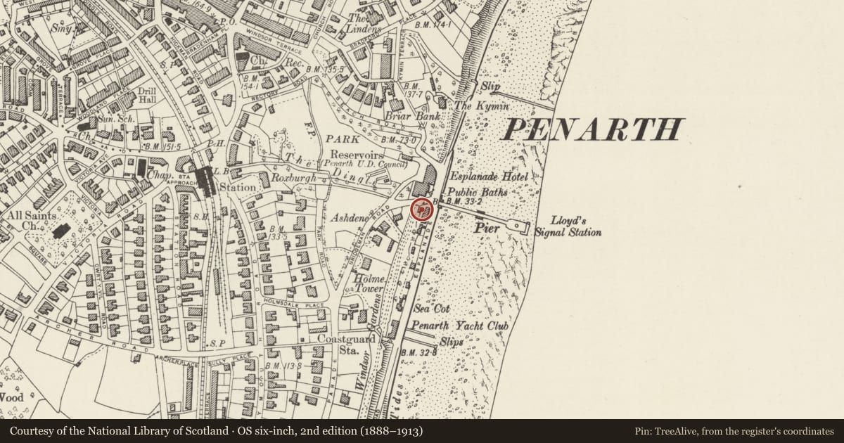
Slide toward Today to fade the historical sheet and see the modern map underneath.
David Rumsey Map Collection, Stanford LibrariesDavid Rumsey Map Collection, Stanford LibrariesDavid Rumsey Map Collection, Stanford LibrariesDavid Rumsey Map Collection, Stanford LibrariesDavid Rumsey Map Collection, Stanford Libraries
5 historical maps cover this location, the earliest the 1636 map "Cornubia : Devonia, Somersetus, Dorcestria, Wiltonia, Glocestria ..." (David Rumsey Map Collection, Stanford Libraries).
Historical maps covering this location
- 1636 · Cornubia : Devonia, Somersetus, Dorcestria, Wiltonia, Glocestria ... (David Rumsey Map Collection, Stanford Libraries)
- 1865 · England and Wales. England No. 6. (David Rumsey Map Collection, Stanford Libraries)
- 1895 · Sheet 11. Ordnance Survey of England and Wales. (David Rumsey Map Collection, Stanford Libraries)
- 1898 · 263 Cardiff (Hills) (David Rumsey Map Collection, Stanford Libraries)
- 1913 · Sheet 110. Cardiff & Mouth of the Severn. (David Rumsey Map Collection, Stanford Libraries)
Cadw's description
Location
At N entrance to Windsor Park facing roughly W.
Exterior
Single storey plus attic. Red pressed brick with moulded brick cornice and frieze; pale stone sills; hipped roof in banded red and brown tiles. Compact plan with central chimney stack with moulded brick cornice. Central projecting bay with hipped two-window dormer to attic. Central bay has ground floor rectangular projecting window, three lights to front. To L of bay, door under wooden porch with horseshoe arch. To R two-bay wooden porch; door with small pane glazing to R.
To north (L) side elevation three narrow camber-headed windows; central window set higher.
To south (R) side three similar windows with square heads all at same level.
Rear has attic gable; modern extension to ground floor.
Nearby in the register
- Inn at the Deep End (former Penarth Baths & Supervisor's Office)Commercialunder 1 mi
- Telephone Call-box in front of the Pavilion and PierCommunicationsunder 1 mi
- Penarth Pier (includingI Pavilion & Shops)Commercialunder 1 mi
- CenotaphCommemorativeunder 1 mi
Other entries of the same register within about three miles of this one, by straight line.