Cof Cymru: National Historic Assets of Wales · Wales
Walls of Entrance Forecourt flanking the Bridge at St Donats Castle
St. Donats, Vale of Glamorgan, Wales
A Grade II listed building in St Donats Castle, Cowbridge / Y Bont-Faen, St. Donats, Vale of Glamorgan, designated on 10 September 1982.
The record
- Designation
- Listed building, Grade II
- Broad class
- Defence
- Date of designation
- 10 September 1982
- Locality
- St Donats Castle
- Town
- Cowbridge / Y Bont-Faen
- Community
- St. Donats
- Unitary authority
- Vale of Glamorgan
- Country
- Wales
- Coordinates
- 51.40222, -3.53294
- Cadw reference
- 13320
Slide toward Today to fade the historical sheet and see the modern map underneath.
David Rumsey Map Collection, Stanford LibrariesDavid Rumsey Map Collection, Stanford LibrariesDavid Rumsey Map Collection, Stanford LibrariesDavid Rumsey Map Collection, Stanford LibrariesDavid Rumsey Map Collection, Stanford Libraries
5 historical maps cover this location, the earliest the 1636 map "Cornubia : Devonia, Somersetus, Dorcestria, Wiltonia, Glocestria ..." (David Rumsey Map Collection, Stanford Libraries).
Historical maps covering this location
- 1636 · Cornubia : Devonia, Somersetus, Dorcestria, Wiltonia, Glocestria ... (David Rumsey Map Collection, Stanford Libraries)
- 1858 · 20. Bridgewater. (David Rumsey Map Collection, Stanford Libraries)
- 1865 · England and Wales. England No. 6. (David Rumsey Map Collection, Stanford Libraries)
- 1897 · 262 Pontypridd (Hills) (David Rumsey Map Collection, Stanford Libraries)
- 1897 · 262 Pontypridd (Outline) (David Rumsey Map Collection, Stanford Libraries)
Cadw's description
Location
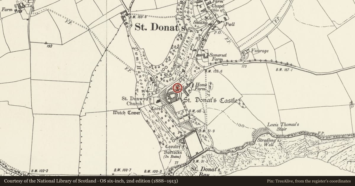
On either side of the Entrance Bridge at St Donats Castle.
History
Of different dates of construction, but probably mostly late C19, and repaired in the late C20.
Exterior
Local lias limestone rubble. South-east (left) of the castle entrance bridge, a thin boundary wall about 2m in height, incorporating an archway, extends as far as the north-west angle of the forecourt stables. The forecourt wall has been lowered since the early C20 on the north-west (right) of the bridge (see Country Life, 31 August 1907, p 315); it was probably done in the 1920s. The archway to the kitchen yard was made narrower in the 1970s to form a pointed arch with parapet over.
Reason for designation
Included for its special interest and group value as a part of St. Donat's Castle and its associated gardens.
Nearby in the register
- Wall of Entrance Forecourt at St Donats Castle and part of North-west Boundary WallDomesticunder 1 mi
- Former Forecourt Stables at St Donats CastleEducationunder 1 mi
- St Donats Castle (United World College of the (Atlantic), including entrance BridgeEducationunder 1 mi
- St Donats Arts CentreEducationunder 1 mi
Other entries of the same register within about three miles of this one, by straight line.