Cof Cymru: National Historic Assets of Wales · Wales
21 Westgate
Cowbridge with Llanblethian, Vale of Glamorgan, Wales
A Grade II listed building in Cowbridge, Cowbridge with Llanblethian, Vale of Glamorgan, designated on 3 February 1981.
The record
- Designation
- Listed building, Grade II
- Broad class
- Domestic
- Date of designation
- 3 February 1981
- Locality
- Cowbridge
- Community
- Cowbridge with Llanblethian
- Unitary authority
- Vale of Glamorgan
- Country
- Wales
- Coordinates
- 51.46323, -3.45352
- Cadw reference
- 13237
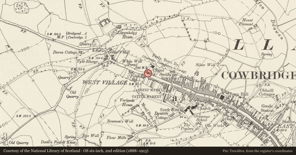
Slide toward Today to fade the historical sheet and see the modern map underneath.
David Rumsey Map Collection, Stanford LibrariesDavid Rumsey Map Collection, Stanford LibrariesDavid Rumsey Map Collection, Stanford LibrariesDavid Rumsey Map Collection, Stanford LibrariesDavid Rumsey Map Collection, Stanford Libraries
5 historical maps cover this location, the earliest the 1636 map "Cornubia : Devonia, Somersetus, Dorcestria, Wiltonia, Glocestria ..." (David Rumsey Map Collection, Stanford Libraries).
Historical maps covering this location
- 1636 · Cornubia : Devonia, Somersetus, Dorcestria, Wiltonia, Glocestria ... (David Rumsey Map Collection, Stanford Libraries)
- 1637 · The fourth table of England. Cornub. Devonia, Somerset etc. (David Rumsey Map Collection, Stanford Libraries)
- 1865 · England and Wales. England No. 6. (David Rumsey Map Collection, Stanford Libraries)
- 1897 · 262 Pontypridd (Hills) (David Rumsey Map Collection, Stanford Libraries)
- 1897 · 262 Pontypridd (Outline) (David Rumsey Map Collection, Stanford Libraries)
Cadw's description
Location
To S of Ramoth Chapel (united free church). Passageway forms entrance to chapel yard.
History
Early-to-mid C19. Shown on the 1841 Tithe Map.
Exterior
Two storey, two window building with smooth render, and slate gabled roof with modern brick flanking stacks. Renewed 16-pane sash windows, not descending to original sill level. Round-arched entrance doorway to R has fanlight and ledged door and, to right hand, a wider round headed arch to passageway with pair of inset C19 iron gates. Gates in passageway have roundels set between middle rails and uprights rising alternately above middle and top rails with arrowhead finials above downward curving top rails. Passageway with stone flagged floor. Rear elevation of house with three cambered headed sash windows with glazing bars on first floor; semi elliptical arch to rear of passageway.
Reason for designation
Unspoilt early C19 house with group value with Ramoth Chapel (United Free Church).
Nearby in the register
- 34 WestgateDomesticunder 1 mi
- Police StationCivilunder 1 mi
- United Free Church (Ramoth Chapel)Religious, Ritual and Funeraryunder 1 mi
- Water Pump near Police StationWater Supply and Drainageunder 1 mi
Other entries of the same register within about three miles of this one, by straight line.