Cof Cymru: National Historic Assets of Wales · Wales
NW Garden Wall to Rose Cottage and SW Garden Walls to Old Hall & Grammar School Garden at SE
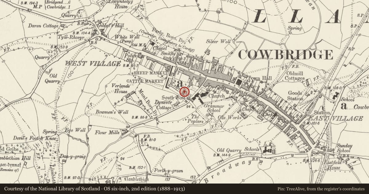
Cowbridge with Llanblethian, Vale of Glamorgan, Wales
A Grade II listed building in Cowbridge, Cowbridge with Llanblethian, Vale of Glamorgan, designated on 3 February 1981.
The record
- Designation
- Listed building, Grade II
- Broad class
- Domestic
- Date of designation
- 3 February 1981
- Locality
- Cowbridge
- Community
- Cowbridge with Llanblethian
- Unitary authority
- Vale of Glamorgan
- Country
- Wales
- Coordinates
- 51.46151, -3.45088
- Cadw reference
- 13233
Slide toward Today to fade the historical sheet and see the modern map underneath.
David Rumsey Map Collection, Stanford LibrariesDavid Rumsey Map Collection, Stanford LibrariesDavid Rumsey Map Collection, Stanford LibrariesDavid Rumsey Map Collection, Stanford LibrariesDavid Rumsey Map Collection, Stanford Libraries
5 historical maps cover this location, the earliest the 1636 map "Cornubia : Devonia, Somersetus, Dorcestria, Wiltonia, Glocestria ..." (David Rumsey Map Collection, Stanford Libraries).
Historical maps covering this location
- 1636 · Cornubia : Devonia, Somersetus, Dorcestria, Wiltonia, Glocestria ... (David Rumsey Map Collection, Stanford Libraries)
- 1637 · The fourth table of England. Cornub. Devonia, Somerset etc. (David Rumsey Map Collection, Stanford Libraries)
- 1865 · England and Wales. England No. 6. (David Rumsey Map Collection, Stanford Libraries)
- 1897 · 262 Pontypridd (Hills) (David Rumsey Map Collection, Stanford Libraries)
- 1897 · 262 Pontypridd (Outline) (David Rumsey Map Collection, Stanford Libraries)
Cadw's description
Location
To W and rear of Rose Cottage.
History
These appear to be in part C18 or C19 garden walls built on the line of the medieval town walls, probably incorporating the medieval town walls in the foundations and possibly in their own walling.
Exterior
Stone rubble wall, lower and less thick than the adjacent listed Town Walls to W
Reason for designation
As structure preserving historic line of medieval town walls. Group value with Town Walls and Rose Cottage.
Nearby in the register
- Town WallsDefenceunder 1 mi
- Rose Cottage, including forecourt garden wallsDomesticunder 1 mi
- SE Wall To former Grammar School GardenEducationunder 1 mi
- South Gate (Porth y Felin)Domesticunder 1 mi
Other entries of the same register within about three miles of this one, by straight line.