Cof Cymru: National Historic Assets of Wales · Wales
23 High Street
Cowbridge with Llanblethian, Vale of Glamorgan, Wales
A Grade II listed building in Cowbridge, Cowbridge with Llanblethian, Vale of Glamorgan, designated on 5 December 1963.
The record
- Designation
- Listed building, Grade II
- Broad class
- Domestic
- Date of designation
- 5 December 1963
- Town
- Cowbridge
- Community
- Cowbridge with Llanblethian
- Unitary authority
- Vale of Glamorgan
- Country
- Wales
- Coordinates
- 51.46195, -3.44748
- Cadw reference
- 13202
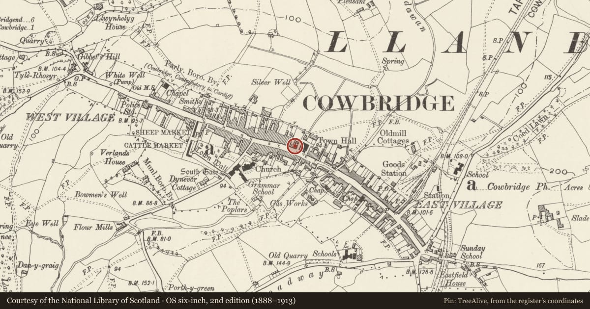
Slide toward Today to fade the historical sheet and see the modern map underneath.
David Rumsey Map Collection, Stanford LibrariesDavid Rumsey Map Collection, Stanford LibrariesDavid Rumsey Map Collection, Stanford LibrariesDavid Rumsey Map Collection, Stanford LibrariesDavid Rumsey Map Collection, Stanford Libraries
5 historical maps cover this location, the earliest the 1636 map "Cornubia : Devonia, Somersetus, Dorcestria, Wiltonia, Glocestria ..." (David Rumsey Map Collection, Stanford Libraries).
Historical maps covering this location
- 1636 · Cornubia : Devonia, Somersetus, Dorcestria, Wiltonia, Glocestria ... (David Rumsey Map Collection, Stanford Libraries)
- 1637 · The fourth table of England. Cornub. Devonia, Somerset etc. (David Rumsey Map Collection, Stanford Libraries)
- 1865 · England and Wales. England No. 6. (David Rumsey Map Collection, Stanford Libraries)
- 1897 · 262 Pontypridd (Hills) (David Rumsey Map Collection, Stanford Libraries)
- 1897 · 262 Pontypridd (Outline) (David Rumsey Map Collection, Stanford Libraries)
Cadw's description
Location
Immediately to L of Town Hall.
History
Building of C17 or earlier origin, renovated in later C20.
Exterior
Two storey three unit frontage with gabled projecting centre of exposed stone rubble; both end units with ground floor front wall of exposed stone rubble and with stuccoed cladding to upper front wall. Slate gabled roofs. From SE end, SE wing with new neo-Georgian shop window and round-headed doorway with modern glazed door on ground floor; two-light window above. Centre gable with new shop front on ground floor (replacing a two-light window), renewed pair of sash windows with glazing bars on first floor and small attic window. NW wing with round-headed doorway to right hand and new neo-Georgian shop front to left hand; two sash windows with glazing bars on first floor.
Reason for designation
For surviving C17 structure and group value with adjacent listed builidngs.
Nearby in the register
- Water Pump against SE Elevation of No 23 High StreetWater Supply and Drainageunder 1 mi
- Telephone Call-box Outside No 23 High StreetCommunicationsunder 1 mi
- Mounting Block attached to Nos 25 & 27 High StreetDomesticunder 1 mi
- 27 High StreetCommercialunder 1 mi
Other entries of the same register within about three miles of this one, by straight line.