Cof Cymru: National Historic Assets of Wales · Wales
Nos 56 & 58 Eastgate
Cowbridge with Llanblethian, Vale of Glamorgan, Wales
A Grade II listed building in Cowbridge, Cowbridge with Llanblethian, Vale of Glamorgan, designated on 5 December 1963.
The record
- Designation
- Listed building, Grade II
- Broad class
- Domestic
- Date of designation
- 5 December 1963
- Locality
- Cowbridge
- Community
- Cowbridge with Llanblethian
- Unitary authority
- Vale of Glamorgan
- Country
- Wales
- Coordinates
- 51.46080, -3.44495
- Cadw reference
- 13196
Slide toward Today to fade the historical sheet and see the modern map underneath.
David Rumsey Map Collection, Stanford LibrariesDavid Rumsey Map Collection, Stanford LibrariesDavid Rumsey Map Collection, Stanford LibrariesDavid Rumsey Map Collection, Stanford LibrariesDavid Rumsey Map Collection, Stanford Libraries
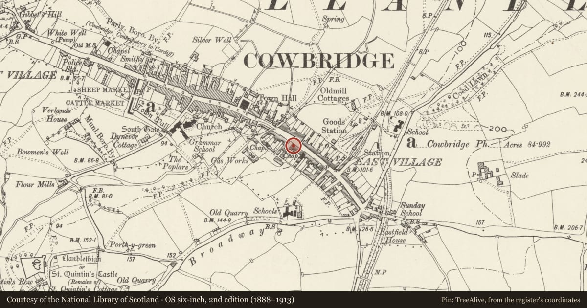
5 historical maps cover this location, the earliest the 1636 map "Cornubia : Devonia, Somersetus, Dorcestria, Wiltonia, Glocestria ..." (David Rumsey Map Collection, Stanford Libraries).
Historical maps covering this location
- 1636 · Cornubia : Devonia, Somersetus, Dorcestria, Wiltonia, Glocestria ... (David Rumsey Map Collection, Stanford Libraries)
- 1637 · The fourth table of England. Cornub. Devonia, Somerset etc. (David Rumsey Map Collection, Stanford Libraries)
- 1865 · England and Wales. England No. 6. (David Rumsey Map Collection, Stanford Libraries)
- 1897 · 262 Pontypridd (Hills) (David Rumsey Map Collection, Stanford Libraries)
- 1897 · 262 Pontypridd (Outline) (David Rumsey Map Collection, Stanford Libraries)
Cadw's description
Location
About 75m SE of junction with The Limes.
History
Late C18 to early C19.
Exterior
Pair of two storey houses set slightly forward from No 54, no 58 with rear parallel range. Front elevations are each two bays wide with pebbledash cladding and stuccoed band; adjacent doorways. Slate gabled roof with lower ridge and higher eaves than No 54; stack to left hand common with No 54 and stone stack to right hand end. No 56 has sash windows without glazing bars. On ground floor, one window to L; to R, two steps to round-headed doorway with open moulded and boarded pediment, painted reveals, plain fanlight with "56" in gold lettering and six-flush panelled door. Two windows on first floor. Similar doorway to No 58 adjoins with appropriate gold lettered number in fanlight. Sixteen-pane sash windows, one to R on ground floor and two on first floor.
Interior
Inside, no 56 has earlier C19 staircase; possibly other contemporary fittings.
Reason for designation
Well-preserved late C18/early C19 houses. Group value with adjacent listed buildings
Nearby in the register
- Heath HouseDomesticunder 1 mi
- 77 EastgateDomesticunder 1 mi
- Citizens' Advice BureauMiscellaneousunder 1 mi
- 71 & 73 EastgateDomesticunder 1 mi
Other entries of the same register within about three miles of this one, by straight line.