Cof Cymru: National Historic Assets of Wales · Wales
East Villa
Cowbridge with Llanblethian, Vale of Glamorgan, Wales
A Grade II listed building in Cowbridge, Cowbridge with Llanblethian, Vale of Glamorgan, designated on 5 December 1963.
The record
- Designation
- Listed building, Grade II
- Broad class
- Domestic
- Date of designation
- 5 December 1963
- Locality
- Cowbridge
- Community
- Cowbridge with Llanblethian
- Unitary authority
- Vale of Glamorgan
- Country
- Wales
- Coordinates
- 51.46052, -3.44434
- Cadw reference
- 13194
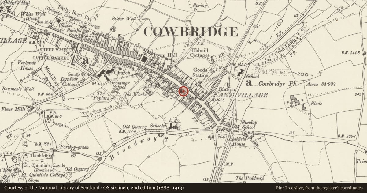
Slide toward Today to fade the historical sheet and see the modern map underneath.
David Rumsey Map Collection, Stanford LibrariesDavid Rumsey Map Collection, Stanford LibrariesDavid Rumsey Map Collection, Stanford LibrariesDavid Rumsey Map Collection, Stanford LibrariesDavid Rumsey Map Collection, Stanford Libraries
5 historical maps cover this location, the earliest the 1636 map "Cornubia : Devonia, Somersetus, Dorcestria, Wiltonia, Glocestria ..." (David Rumsey Map Collection, Stanford Libraries).
Historical maps covering this location
- 1636 · Cornubia : Devonia, Somersetus, Dorcestria, Wiltonia, Glocestria ... (David Rumsey Map Collection, Stanford Libraries)
- 1637 · The fourth table of England. Cornub. Devonia, Somerset etc. (David Rumsey Map Collection, Stanford Libraries)
- 1865 · England and Wales. England No. 6. (David Rumsey Map Collection, Stanford Libraries)
- 1897 · 262 Pontypridd (Hills) (David Rumsey Map Collection, Stanford Libraries)
- 1897 · 262 Pontypridd (Outline) (David Rumsey Map Collection, Stanford Libraries)
Cadw's description
Location
Attached to R of The Armoury, behind railed forecourt.
History
Early C19 front to probably earlier core.
Exterior
Two storey house with cellar. Joint-lined stuccoed two bay front elevation with plinth; slate gabled roof with yellow stock brick stack to NW above very wide external chimney breast with roughcast cladding against NW gable end. 12-pane sash windows; two on first floor, and one to R hand on ground floor. Below left hand first floor window, offset to L, semi-circular doorway with moulded architrave, open pediment with modillions on pilasters, panelled reveals and five panelled door with three tall panels above and two below and fanlight with tracery. Front garden enclosed by dwarf stone wall with moderniron railings. North-west rear wing.
Reason for designation
Well-preserved early C19 house with group value with adjacent listed buildings.
Nearby in the register
- The ArmouryDomesticunder 1 mi
- Ancient DruidDomesticunder 1 mi
- Telephone Call-box Outside Royal Mail Delivery OfficeCommunicationsunder 1 mi
- Heath HouseDomesticunder 1 mi
Other entries of the same register within about three miles of this one, by straight line.