Cof Cymru: National Historic Assets of Wales · Wales
Wellhouse to Ffynnon Fair
Llwyn-y-Pia, Rhondda Cynon Taff, Wales
A Grade II listed building in Llwynypia, Tonypandy, Rhondda Cynon Taff, designated on 20 June 1963.
The record
- Designation
- Listed building, Grade II
- Broad class
- Water Supply and Drainage
- Date of designation
- 20 June 1963
- Locality
- Llwynypia
- Town
- Tonypandy
- Community
- Llwyn-y-Pia
- Unitary authority
- Rhondda Cynon Taff
- Country
- Wales
- Coordinates
- 51.64086, -3.44542
- Cadw reference
- 13113
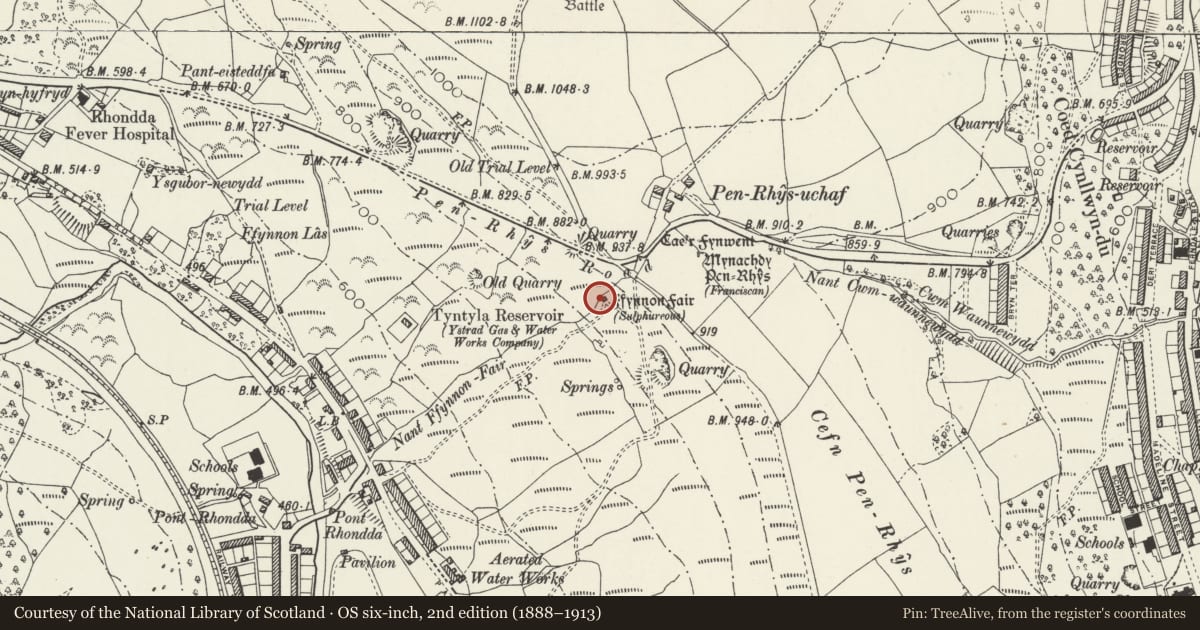
Slide toward Today to fade the historical sheet and see the modern map underneath.
David Rumsey Map Collection, Stanford LibrariesDavid Rumsey Map Collection, Stanford LibrariesDavid Rumsey Map Collection, Stanford LibrariesDavid Rumsey Map Collection, Stanford LibrariesDavid Rumsey Map Collection, Stanford Libraries
5 historical maps cover this location, the earliest the 1636 map "Cornubia : Devonia, Somersetus, Dorcestria, Wiltonia, Glocestria ..." (David Rumsey Map Collection, Stanford Libraries).
Historical maps covering this location
- 1636 · Cornubia : Devonia, Somersetus, Dorcestria, Wiltonia, Glocestria ... (David Rumsey Map Collection, Stanford Libraries)
- 1637 · The fourth table of England. Cornub. Devonia, Somerset etc. (David Rumsey Map Collection, Stanford Libraries)
- 1865 · England and Wales. England No. 6. (David Rumsey Map Collection, Stanford Libraries)
- 1895 · Sheet 11. Ordnance Survey of England and Wales. (David Rumsey Map Collection, Stanford Libraries)
- 1907 · 248 Pontypridd (Hills) (David Rumsey Map Collection, Stanford Libraries)
Cadw's description
Location
High on the E slope of the Rhondda valley above Llwynypia and just SW of Penrhys modern estate.
History
Penrhys is the hilltop site of a medieval Cistercian monastic settlement, a manor or grange belonging to the Abbey of Llantarnam including a statue and shrine to the Virgin Mary: a small part of the late medieval chapel survives adjacent to a large white statue of the Virgin. Set into the hillside a little to SW is a probably medieval wellhouse over the spring which is also dedicated to St Mary; restored early 1920s. Both spring and statue were reputed to have miraculous healing powers, were celebrated in late medieval verse and were the focus of pilgrimages suppressed at the Reformation; these have been revived in C20. The spring is marked as sulphurous on OS maps and its water was also reputedly used for baptisms at the parish church
Exterior
Small single cell rectangular gabled building of stone rubble with stepped stone roof. W wall has a single lancet and a small culvert where spring overflows through wall into a square basin with cross depression at its base; S wall has a square headed doorway with painted inscription over 'Little Church'; E wall has a high raised gable with rough saddle back coping and apex stone surmounted by a concrete cross. The building stands within an enclosure of iron railings now partly broken and on a stone terrace.
Interior
Whitewashed walls and vaulted roof; well cistern at west end; stone benches round walls on 3 sides; N wall niche may have contained statue of St Mary.
Reason for designation
Listed as a surviving small medieval building and for its historical importance as the focus of medieval pilgrimages in South Wales and for its literary interest.
Nearby in the register
- Tyntyla FarmhouseDomesticunder 1 mi
- The Star PHCommercialunder 1 mi
- Welfare HallRecreationalunder 1 mi
- Former Engine House at Llwynypia Colliery SiteIndustrialunder 1 mi
Other entries of the same register within about three miles of this one, by straight line.