Cof Cymru: National Historic Assets of Wales · Wales
Former Rocket Apparatus Store
St. Dogmaels, Pembrokeshire, Wales
A Grade II listed building in Cei Bach, St. Dogmaels, Pembrokeshire, designated on 15 November 1993.
The record
- Designation
- Listed building, Grade II
- Broad class
- Commercial
- Date of designation
- 15 November 1993
- Locality
- Cei Bach
- Community
- St. Dogmaels
- Unitary authority
- Pembrokeshire
- Country
- Wales
- Coordinates
- 52.10612, -4.71084
- Cadw reference
- 13106
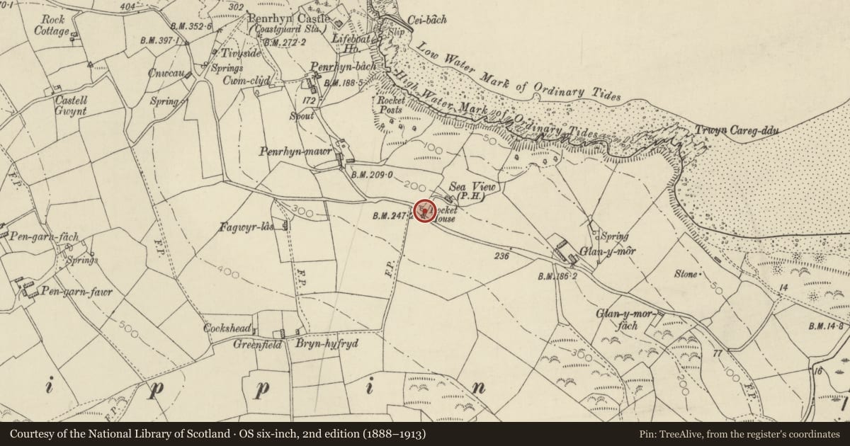
Slide toward Today to fade the historical sheet and see the modern map underneath.
David Rumsey Map Collection, Stanford LibrariesDavid Rumsey Map Collection, Stanford LibrariesDavid Rumsey Map Collection, Stanford LibrariesDavid Rumsey Map Collection, Stanford LibrariesDavid Rumsey Map Collection, Stanford Libraries
5 historical maps cover this location, the earliest the 1608 map "(13) Cambriae Typus." (David Rumsey Map Collection, Stanford Libraries).
Historical maps covering this location
- 1608 · (13) Cambriae Typus. (David Rumsey Map Collection, Stanford Libraries)
- 1637 · Particular description of Wales. Cambria seu Wallia (David Rumsey Map Collection, Stanford Libraries)
- 1830 · V.3:11-15:XV. Britisches Reich. A. Kon: England. b. Frstenthum Wales: Shire: 37-40 (David Rumsey Map Collection, Stanford Libraries)
- 1898 · 193 Cardigan (Hills) (David Rumsey Map Collection, Stanford Libraries)
- 1901 · Sheet 13. (David Rumsey Map Collection, Stanford Libraries)
Cadw's description
Location
Situated by roadside at entry to Seaview (Youth Hostel).
Exterior
Circa 1900 store for coastguard lifesaving apparatus, including rockets for firing ropes to endangered ships. Rubble stone, partly rendered or roughcast. Slate roof and N end brick stack. Single storey on blind base, with big cambered-headed opening to road, stone voussoirs, double ledged doors with iron strap hinges. Sides are roughcast, each with one yellow brick framed window and iron bars.
Reason for designation
Included for historical interest, close to a rocky coastline with few harbours. Penrhyn Castle to N was the former coastguard station and Poppit Lifeboat House lies to SW.
Nearby in the register
- Penrhyn CastleMaritimeunder 1 mi
- BryntirionDomesticunder 1 mi
- PenparcDomesticunder 1 mi
- Burnt Mound 160m SW of Wern-DduBurnt Moundunder 1 mi
Other entries of the same register within about three miles of this one, by straight line.