Cof Cymru: National Historic Assets of Wales · Wales
Telephone Call-box adjoining No 2
Fishguard and Goodwick, Pembrokeshire, Wales
A Grade II listed building in Lower Town, Fishguard, Fishguard and Goodwick, Pembrokeshire, designated on 15 July 1988.
The record
- Designation
- Listed building, Grade II
- Broad class
- Communications
- Date of designation
- 15 July 1988
- Locality
- Lower Town
- Town
- Fishguard
- Community
- Fishguard and Goodwick
- Unitary authority
- Pembrokeshire
- Country
- Wales
- Coordinates
- 51.99569, -4.96847
- Cadw reference
- 13048
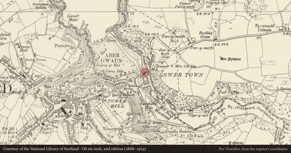
Slide toward Today to fade the historical sheet and see the modern map underneath.
David Rumsey Map Collection, Stanford LibrariesDavid Rumsey Map Collection, Stanford LibrariesDavid Rumsey Map Collection, Stanford LibrariesDavid Rumsey Map Collection, Stanford LibrariesDavid Rumsey Map Collection, Stanford Libraries
5 historical maps cover this location, the earliest the 1608 map "(13) Cambriae Typus." (David Rumsey Map Collection, Stanford Libraries).
Historical maps covering this location
- 1608 · (13) Cambriae Typus. (David Rumsey Map Collection, Stanford Libraries)
- 1891 · Sheet 10. Ordnance Survey of England and Wales. . (David Rumsey Map Collection, Stanford Libraries)
- 1898 · 210 Cardigan (Hills) (David Rumsey Map Collection, Stanford Libraries)
- 1898 · 210 Cardigan (Outline) (David Rumsey Map Collection, Stanford Libraries)
- 1901 · Sheet 13. (David Rumsey Map Collection, Stanford Libraries)
Cadw's description
Location
Situated at the foot of Quay Street, beside the former chapel.
History
Mid C20 telephone kiosk to the standard K6 design of Sir Giles Gilbert Scott, introduced by the GPO in 1936.
Exterior
Telephone kiosk, red-painted cast-iron with wooden door. Horizontal glazing with marginal bars, shallow Soaneian domed roof over lunettes with embossed George VI crown over lettered glass panels.
Reason for designation
Included for heritage location in centre of Lower Town conservation area.
Nearby in the register
- The Dinas ArmsCommercialunder 1 mi
- Justin CottageDomesticunder 1 mi
- Well Cottage/Bwthyn FfynnonDomesticunder 1 mi
- 9 Newport RoadDomesticunder 1 mi
Other entries of the same register within about three miles of this one, by straight line.