Cof Cymru: National Historic Assets of Wales · Wales
Piers & Railings to No 3 Cilwendeg Lodge
Boncath, Pembrokeshire, Wales
A Grade II listed building in Capel Colman, Boncath, Pembrokeshire, designated on 30 January 1980.
The record
- Designation
- Listed building, Grade II
- Broad class
- Domestic
- Date of designation
- 30 January 1980
- Locality
- Capel Colman
- Community
- Boncath
- Unitary authority
- Pembrokeshire
- Country
- Wales
- Coordinates
- 52.01902, -4.60629
- Cadw reference
- 13028
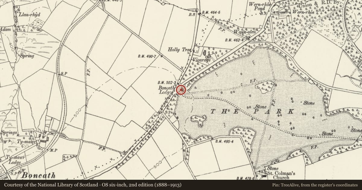
Slide toward Today to fade the historical sheet and see the modern map underneath.
David Rumsey Map Collection, Stanford LibrariesDavid Rumsey Map Collection, Stanford LibrariesDavid Rumsey Map Collection, Stanford LibrariesDavid Rumsey Map Collection, Stanford LibrariesDavid Rumsey Map Collection, Stanford Libraries
5 historical maps cover this location, the earliest the 1608 map "(13) Cambriae Typus." (David Rumsey Map Collection, Stanford Libraries).
Historical maps covering this location
- 1608 · (13) Cambriae Typus. (David Rumsey Map Collection, Stanford Libraries)
- 1636 · Cornubia : Devonia, Somersetus, Dorcestria, Wiltonia, Glocestria ... (David Rumsey Map Collection, Stanford Libraries)
- 1637 · Particular description of Wales. Cambria seu Wallia (David Rumsey Map Collection, Stanford Libraries)
- 1830 · V.3:11-15:XV. Britisches Reich. A. Kon: England. b. Frstenthum Wales: Shire: 37-40 (David Rumsey Map Collection, Stanford Libraries)
- 1891 · Sheet 10. Ordnance Survey of England and Wales. . (David Rumsey Map Collection, Stanford Libraries)
Cadw's description
Location
Situated at head of main drive to Cilwendeg, the eastern lodge of pair, on B 4332, E of Boncath.
History
Probably built c 1830 by Morgan Jones 2 of Cilwendeg as lodge to main drive, as two lodges are recorded in 1833 as `recently built by the present proprietor', but these may be the Newchapel lodges. Marked on 1846 Tithe Map.
Exterior
c1830 entrance lodge to Cilwendeg, stucco, single storey with hipped eaves roofs, T-plan, corniced stack to rear of front range and truncated stack to rear of rear wing. Three-bay front with plain pilasters at angles and framing recessed centre entry, with 6-panel door and traceried overlight. Raised plinth and eaves band. 12-pane sashes in square-headed recesses each side of door and on N end wall, and N side of rear wing. Blank similar recessed windows in S end wall and rear end of wing. Plinth is set back at window recesses.
Railings include quadrant running NE to ashlar terminal pier and larger part of original entrance screen, a length of rails, main gates with two similar piers and further length of rails broken for present entrance way. Ashlar low coping and spearhead rails with cast-iron spears. High ashlar piers with moulded bases, broad cornices and two-step caps. Main gates have similar rails and dog-bars, ramped top-rails and mid-rail with cast-iron roundels.
The two lodges and the complete set of rails were formerly listed as two separate items.
Nearby in the register
- No 3 Cilwendeg LodgeDomesticunder 1 mi
- Piers & Railings to No 4 Cilwendeg LodgeDomesticunder 1 mi
- No 4 Cilwendeg LodgeDomesticunder 1 mi
- Church of St ColmanReligious, Ritual and Funeraryunder 1 mi
Other entries of the same register within about three miles of this one, by straight line.