Cof Cymru: National Historic Assets of Wales · Wales
Tregwynt Woollen Mill
Pencaer, Pembrokeshire, Wales
A Grade II listed building in Tregwynt, St Nicolas/Tremarchog, Pencaer, Pembrokeshire, designated on 14 July 1993.
The record
- Designation
- Listed building, Grade II
- Broad class
- Industrial
- Date of designation
- 14 July 1993
- Locality
- Tregwynt
- Town
- St Nicolas/Tremarchog
- Community
- Pencaer
- Unitary authority
- Pembrokeshire
- Country
- Wales
- Coordinates
- 51.97210, -5.06697
- Cadw reference
- 12998
Slide toward Today to fade the historical sheet and see the modern map underneath.
David Rumsey Map Collection, Stanford LibrariesDavid Rumsey Map Collection, Stanford LibrariesDavid Rumsey Map Collection, Stanford LibrariesDavid Rumsey Map Collection, Stanford LibrariesDavid Rumsey Map Collection, Stanford Libraries
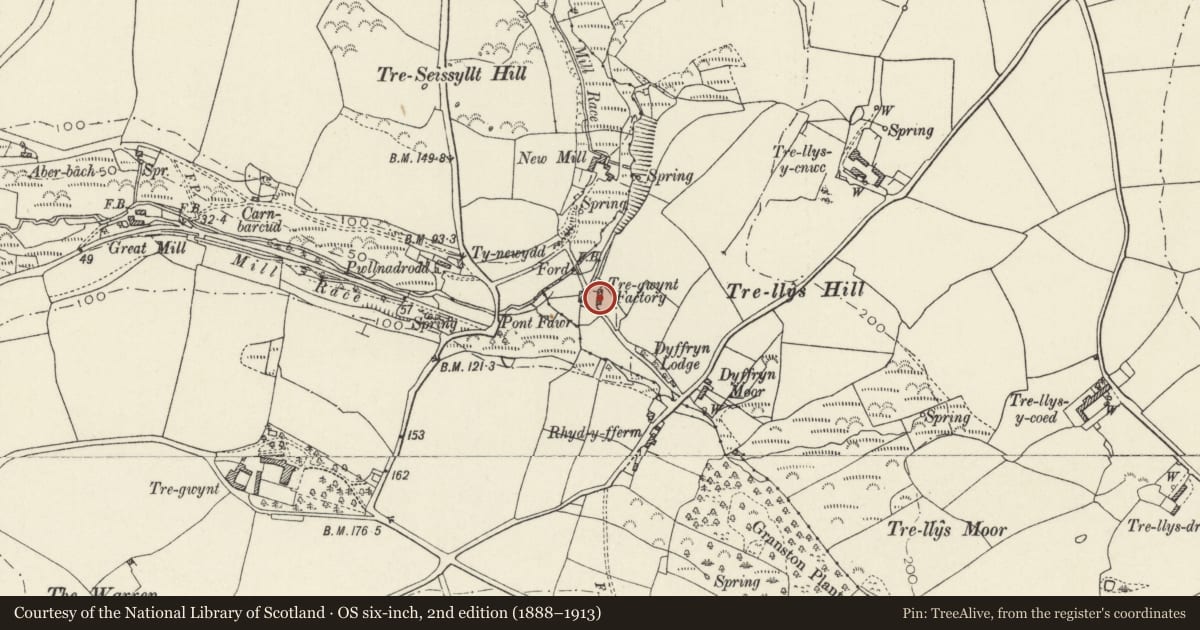
5 historical maps cover this location, the earliest the 1608 map "(13) Cambriae Typus." (David Rumsey Map Collection, Stanford Libraries).
Historical maps covering this location
- 1608 · (13) Cambriae Typus. (David Rumsey Map Collection, Stanford Libraries)
- 1636 · Cornubia : Devonia, Somersetus, Dorcestria, Wiltonia, Glocestria ... (David Rumsey Map Collection, Stanford Libraries)
- 1637 · Particular description of Wales. Cambria seu Wallia (David Rumsey Map Collection, Stanford Libraries)
- 1898 · 209 St David's (Hills) (David Rumsey Map Collection, Stanford Libraries)
- 1901 · Sheet 13. (David Rumsey Map Collection, Stanford Libraries)
Cadw's description
Location
Situated on lane some 700m N of Granston, E of Aberbach.
History
Marked on 1841 Tithe Map, then called Dyffryn Bach, owned by G J Harries and occupied by David Evans.
Exterior
Early C19 water mill, whitewashed rubble stone with hipped asbestos-sheet roof. One rebuilt brick ridge stack. Two-storey front divided by earth embankment up to first floor door, to right of centre. One 12-pane sash to right and small ground floor window below. To left 12-pane sash and 16-pane sash over door, small 6-pane window and 16-pane sash. Rubble stone left end wall with ground floor door and C20 window. Rubble stone right end wall with curved angles and projecting square upper corners. One C20 window each floor. Rear has big C20 lean-to machinery shed for looms.
Interior
Ground floor centre big internal iron water-wheel, overshot, probably later C19. First-floor collar truss roof in pine with wooden pegs. One truss at left end dated ?/7/1819.
Reason for designation
One of the last working woollen mills in Dyfed; owned by Griffiths family since 1912.
Nearby in the register
- Ty-NewyddDomesticunder 1 mi
- TregwyntDomesticunder 1 mi
- North Wing & Low Farm Range to W.of TregwyntDomesticunder 1 mi
- Farm Court at Granston HallAgriculture and Subsistenceunder 1 mi
Other entries of the same register within about three miles of this one, by straight line.