Cof Cymru: National Historic Assets of Wales · Wales
Former Coach-House & Stable at Priskilly Forest
Mathry, Pembrokeshire, Wales
A Grade II listed building in Priskilly Forest, Mathry, Pembrokeshire, designated on 29 April 1993.
The record
- Designation
- Listed building, Grade II
- Broad class
- Domestic
- Date of designation
- 29 April 1993
- Locality
- Priskilly Forest
- Community
- Mathry
- Unitary authority
- Pembrokeshire
- Country
- Wales
- Coordinates
- 51.92982, -5.02996
- Cadw reference
- 12962
Slide toward Today to fade the historical sheet and see the modern map underneath.
David Rumsey Map Collection, Stanford LibrariesDavid Rumsey Map Collection, Stanford LibrariesDavid Rumsey Map Collection, Stanford LibrariesDavid Rumsey Map Collection, Stanford LibrariesDavid Rumsey Map Collection, Stanford Libraries
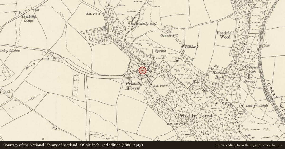
5 historical maps cover this location, the earliest the 1608 map "(13) Cambriae Typus." (David Rumsey Map Collection, Stanford Libraries).
Historical maps covering this location
- 1608 · (13) Cambriae Typus. (David Rumsey Map Collection, Stanford Libraries)
- 1636 · Cornubia : Devonia, Somersetus, Dorcestria, Wiltonia, Glocestria ... (David Rumsey Map Collection, Stanford Libraries)
- 1637 · Particular description of Wales. Cambria seu Wallia (David Rumsey Map Collection, Stanford Libraries)
- 1898 · 209 St David's (Hills) (David Rumsey Map Collection, Stanford Libraries)
- 1901 · Sheet 13. (David Rumsey Map Collection, Stanford Libraries)
Cadw's description
Location
Situated to SE of house, facing over yard.
Exterior
Earlier C19 coach-house and stable in whitewashed rubble stone with slate and corrugated asbestos roofs. Formal gabled centrepiece with blank roundel, two first floor 6-pane windows and two camber-headed coach-entries below. Brick voussoirs. Brick end stack to rear. Single-storey hipped wings each side, that to left shorter with gabled addition coming forward at left end; that to right with broad opening and timber lintel, then 12-pane window with stone voussoirs and door with stone voussoris.
Reason for designation
Included for group value.
Buildings to different plan form marked on map in Bishop of St David's map book 1815 in National Library of Wales and on 1843 Tithe Map.
Nearby in the register
- Priskilly ForestDomesticunder 1 mi
- Ty-Newydd-Grug Standing StoneStanding Stoneunder 1 mi
- Silo Tower at Llangwarren FarmAgriculture and Subsistence1 mi
- Pont Llangwarren (partly in Scleddau Community)Transport1 mi
Other entries of the same register within about three miles of this one, by straight line.