Cof Cymru: National Historic Assets of Wales · Wales
Pencnwc
Mathry, Pembrokeshire, Wales
A Grade II listed building in Castle Morris/Casmorys, Mathry, Pembrokeshire, designated on 29 April 1993.
The record
- Designation
- Listed building, Grade II
- Broad class
- Domestic
- Date of designation
- 29 April 1993
- Locality
- Castle Morris/Casmorys
- Community
- Mathry
- Unitary authority
- Pembrokeshire
- Country
- Wales
- Coordinates
- 51.94318, -5.05187
- Cadw reference
- 12956
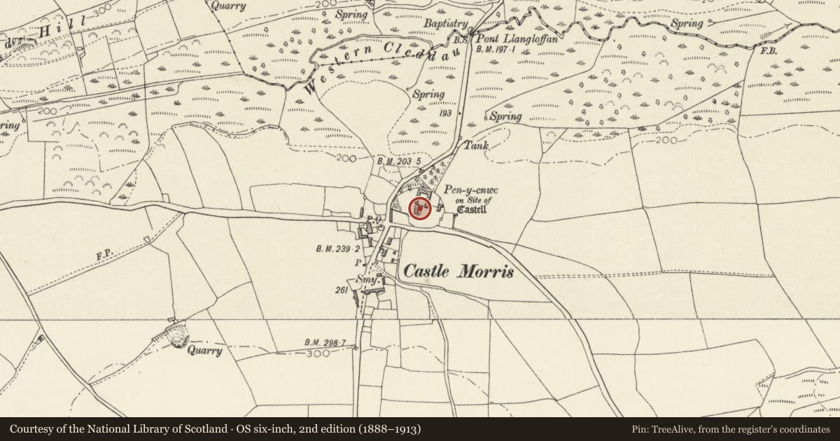
Slide toward Today to fade the historical sheet and see the modern map underneath.
David Rumsey Map Collection, Stanford LibrariesDavid Rumsey Map Collection, Stanford LibrariesDavid Rumsey Map Collection, Stanford LibrariesDavid Rumsey Map Collection, Stanford LibrariesDavid Rumsey Map Collection, Stanford Libraries
5 historical maps cover this location, the earliest the 1608 map "(13) Cambriae Typus." (David Rumsey Map Collection, Stanford Libraries).
Historical maps covering this location
- 1608 · (13) Cambriae Typus. (David Rumsey Map Collection, Stanford Libraries)
- 1636 · Cornubia : Devonia, Somersetus, Dorcestria, Wiltonia, Glocestria ... (David Rumsey Map Collection, Stanford Libraries)
- 1637 · Particular description of Wales. Cambria seu Wallia (David Rumsey Map Collection, Stanford Libraries)
- 1898 · 209 St David's (Hills) (David Rumsey Map Collection, Stanford Libraries)
- 1901 · Sheet 13. (David Rumsey Map Collection, Stanford Libraries)
Cadw's description
Location
Situated to NE of crossroads in Castle Morris.
History
A substantial farmhouse built in two phases, formerly part of the Bishop of St Davids' estate, Abraham Leach lessee in 1843, but occupied by William Evans (1843 Tithe Map).
Exterior
Early and later C19 farmhouse, rendered rubble stone with slate roof, two red brick stacks and one large N end stone stack. Two-storey long front, the earlier part to right. Four hornless 12-pane sashes above and later C19 ground-floor bay and door to left; similar bay, door and C20 triple casement to right. Bays are rendered and square with paired plate-glass sashes to front and hipped roofs. Lean-to on N end.
Rear projecting wing to older part, in rubble stone with first floor W end 12-pane sash, brick head, window on ground floor N side and then outshut in NW angle. Continuous outshut to right of wing, ground floor 4-pane sash and first floor 12-pane to older part. South section has long plate-glass stair light, and first floor 9-pane sash to right, over small window. Stone cornerstones.
Nearby in the register
- Former Mill in Outbuildings to N.of PencnwcIndustrialunder 1 mi
- Pont Llangloffan (partly in Mathry Community)Transportunder 1 mi
- Llangloffan Baptist ChapelReligious, Ritual and Funeraryunder 1 mi
- Outbuilding at N.End of E.Farmyard range at Llangloffan Farm LlangloffanAgriculture and Subsistenceunder 1 mi
Other entries of the same register within about three miles of this one, by straight line.