Cof Cymru: National Historic Assets of Wales · Wales
Castle Cenlas
Mathry, Pembrokeshire, Wales
A Grade II listed building in Castle Cenlas/Castell Cenlas, Mathry, Pembrokeshire, designated on 29 April 1993.
The record
- Designation
- Listed building, Grade II
- Broad class
- Domestic
- Date of designation
- 29 April 1993
- Locality
- Castle Cenlas/Castell Cenlas
- Community
- Mathry
- Unitary authority
- Pembrokeshire
- Country
- Wales
- Coordinates
- 51.93024, -5.10506
- Cadw reference
- 12955
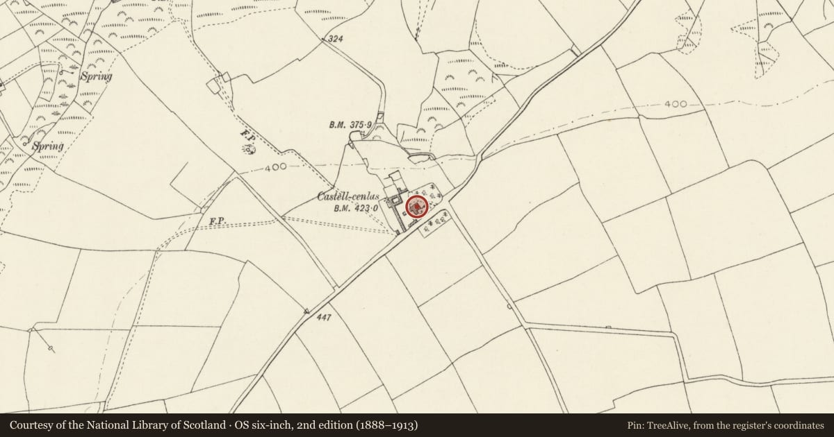
Slide toward Today to fade the historical sheet and see the modern map underneath.
David Rumsey Map Collection, Stanford LibrariesDavid Rumsey Map Collection, Stanford LibrariesDavid Rumsey Map Collection, Stanford LibrariesDavid Rumsey Map Collection, Stanford LibrariesDavid Rumsey Map Collection, Stanford Libraries
5 historical maps cover this location, the earliest the 1608 map "(13) Cambriae Typus." (David Rumsey Map Collection, Stanford Libraries).
Historical maps covering this location
- 1608 · (13) Cambriae Typus. (David Rumsey Map Collection, Stanford Libraries)
- 1636 · Cornubia : Devonia, Somersetus, Dorcestria, Wiltonia, Glocestria ... (David Rumsey Map Collection, Stanford Libraries)
- 1637 · Particular description of Wales. Cambria seu Wallia (David Rumsey Map Collection, Stanford Libraries)
- 1898 · 209 St David's (Hills) (David Rumsey Map Collection, Stanford Libraries)
- 1901 · Sheet 13. (David Rumsey Map Collection, Stanford Libraries)
Cadw's description
Location
Situated on ridge some 2.3 km SW of Mathry.
History
1843 Tithe Map and 1856 map in National Library of Wales show only front range built; in 1843 the house was owned by Richard Mathias and in 1856 was the property of Mrs L Jones, occupied by Mr Matthias.
Exterior
Earlier C19 small country house, rendered unpainted front, render removed and stone colourwashed to side and rear, slate hipped roofs and brick stack on ridge of rear wing. Two-storey three-window E front of 12-pane sashes and centre door in added gabled, glazed porch. Inner 6-panel door with traceried fanlight. North end of front range has 12-pane sash each floor. N-facing wing to right has two-window range of 12-pane sashes and then, to right, a smaller 4-pane sash each floor and small attic window under eaves; hipped W end, with additional parallel rear range in angle. Long C19 stair-light.
Nearby in the register
- LochturffinDomesticunder 1 mi
- Outbuilding attached to W.of LochturffinDomesticunder 1 mi
- Tre-Wallter Llwyd Burial ChamberChambered Tombunder 1 mi
- Standing Stone 100m ENE of Blaen-llynStanding Stoneunder 1 mi
Other entries of the same register within about three miles of this one, by straight line.