Cof Cymru: National Historic Assets of Wales · Wales
Small Outbuildings to SW.of Carnachenwen Farmhouse
Mathry, Pembrokeshire, Wales
A Grade II listed building in Mathry, Pembrokeshire, designated on 29 April 1993.
The record
- Designation
- Listed building, Grade II
- Broad class
- Agriculture and Subsistence
- Date of designation
- 29 April 1993
- Community
- Mathry
- Unitary authority
- Pembrokeshire
- Country
- Wales
- Coordinates
- 51.95476, -5.09235
- Cadw reference
- 12952
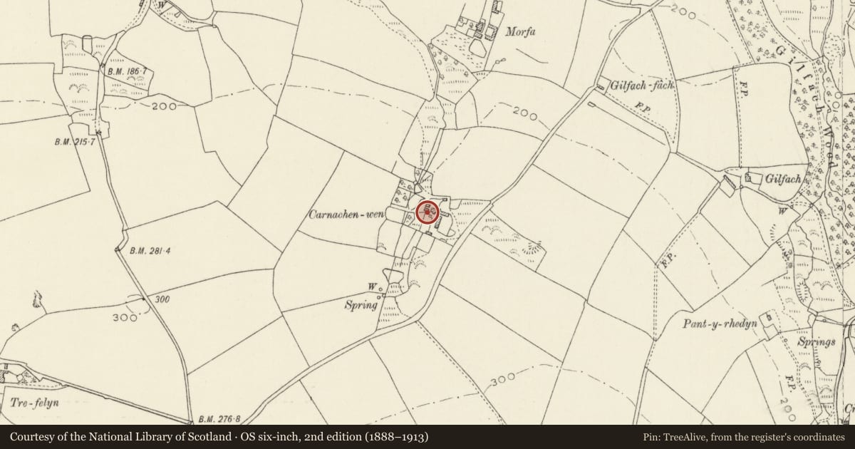
Slide toward Today to fade the historical sheet and see the modern map underneath.
David Rumsey Map Collection, Stanford LibrariesDavid Rumsey Map Collection, Stanford LibrariesDavid Rumsey Map Collection, Stanford LibrariesDavid Rumsey Map Collection, Stanford LibrariesDavid Rumsey Map Collection, Stanford Libraries
5 historical maps cover this location, the earliest the 1608 map "(13) Cambriae Typus." (David Rumsey Map Collection, Stanford Libraries).
Historical maps covering this location
- 1608 · (13) Cambriae Typus. (David Rumsey Map Collection, Stanford Libraries)
- 1636 · Cornubia : Devonia, Somersetus, Dorcestria, Wiltonia, Glocestria ... (David Rumsey Map Collection, Stanford Libraries)
- 1637 · Particular description of Wales. Cambria seu Wallia (David Rumsey Map Collection, Stanford Libraries)
- 1898 · 209 St David's (Hills) (David Rumsey Map Collection, Stanford Libraries)
- 1901 · Sheet 13. (David Rumsey Map Collection, Stanford Libraries)
Cadw's description
Location
Known as Ty'r Odyn and Stond Agolch, both situated immediately opposite SW corner of house.
History
Later C18 outbuilding known as Ty'r Odyn
Exterior
Is whitewashed rubble stone with corrugated iron roof. Single-storey, curved angles and E end double doors. Dove-holes and small window over door. Two blocked doors on N side, facing house, one with small window inserted. No evidence of kiln function.
Closely adjoining to W is an open-fronted low building, called Stond Agolch, for storing and mixing culm; single pitch corrugated iron roof, two compartments including square stone 'bin' and whitewashed rubble walls.
Reason for designation
Included as good examples of smaller traditional outbuildings in the area. Group value with farmhouse and other outbuildings in extensive farm layout.
Not marked on 1767 estate map in National Library of Wales Collection 491.
Nearby in the register
- Pigsties at CarnachenwenAgriculture and Subsistenceunder 1 mi
- Small Outbuildings to SW.of Carnachenwen FarmhouseAgriculture and Subsistenceunder 1 mi
- CarnachenwenDomesticunder 1 mi
- Outbuilding to NW.of House at CarnachenwenDomesticunder 1 mi
Other entries of the same register within about three miles of this one, by straight line.