Cof Cymru: National Historic Assets of Wales · Wales
The Kings Arms
Milford Haven, Pembrokeshire, Wales
A Grade II listed building in Hakin, Milford Haven, Pembrokeshire, designated on 22 February 1993.
The record
- Designation
- Listed building, Grade II
- Broad class
- Commercial
- Date of designation
- 22 February 1993
- Locality
- Hakin
- Community
- Milford Haven
- Unitary authority
- Pembrokeshire
- Country
- Wales
- Coordinates
- 51.70869, -5.03994
- Cadw reference
- 12923
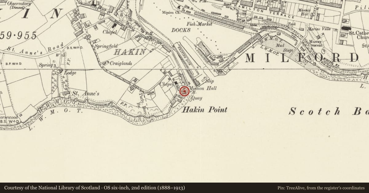
Slide toward Today to fade the historical sheet and see the modern map underneath.
David Rumsey Map Collection, Stanford LibrariesDavid Rumsey Map Collection, Stanford LibrariesDavid Rumsey Map Collection, Stanford LibrariesDavid Rumsey Map Collection, Stanford LibrariesDavid Rumsey Map Collection, Stanford Libraries
5 historical maps cover this location, the earliest the 1636 map "Cornubia : Devonia, Somersetus, Dorcestria, Wiltonia, Glocestria ..." (David Rumsey Map Collection, Stanford Libraries).
Historical maps covering this location
- 1636 · Cornubia : Devonia, Somersetus, Dorcestria, Wiltonia, Glocestria ... (David Rumsey Map Collection, Stanford Libraries)
- 1865 · England and Wales. England No. 6. (David Rumsey Map Collection, Stanford Libraries)
- 1898 · 227 Milford (Outline) (David Rumsey Map Collection, Stanford Libraries)
- 1898 · 227 Milford (Hills) (David Rumsey Map Collection, Stanford Libraries)
- 1901 · Sheet 13. (David Rumsey Map Collection, Stanford Libraries)
Cadw's description
Location
Prominently situated on Hakin Point, overlooking Docks entrance.
History
Mid to later Cl9 public house in painted stucco with slate roof and painted brick end stacks.
Exterior
Three-storey 4-window front with ground floor public house facade of overall fascia between gabled brackets on pilasters, and upper floor 4-pane sashes in moulded architraves, those on first floor with cornices also. Eaves gutter held between projecting brackets. One first floor N end window.
Ground floor has late Cl9 sash windows with small panes to upper sashes and panels below sills. Door to right with blank overlight, then two pairs of sashes with plain pier between and flanking pilasters to match outer pilasters, then pair of sashes and single sash with plain dividing piers. Pilasters are late Cl9 type with conventional caps at 2/3rds height and additional upper part up to outer brackets of fascia.
Reason for designation
Included for prominence in views of Milford.
Nearby in the register
- One of 5 Bollards along SW.Side of Graving Dock at Milford DocksGardens, Parks and Urban Spacesunder 1 mi
- One of 5 Bollards along SW.Side of Graving Dock at Milford DocksGardens, Parks and Urban Spacesunder 1 mi
- One of 5 Bollards along SW.Side of Graving Dock at Milford DocksGardens, Parks and Urban Spacesunder 1 mi
- One of 28 Bollards Flanking Entrance LockGardens, Parks and Urban Spacesunder 1 mi
Other entries of the same register within about three miles of this one, by straight line.