Cof Cymru: National Historic Assets of Wales · Wales
Quay Stores
Milford Haven, Pembrokeshire, Wales
A Grade II listed building in Milfprd Haven, Milford Haven, Pembrokeshire, designated on 22 August 1975.
The record
- Designation
- Listed building, Grade II
- Broad class
- Commercial
- Date of designation
- 22 August 1975
- Town
- Milfprd Haven
- Community
- Milford Haven
- Unitary authority
- Pembrokeshire
- Country
- Wales
- Coordinates
- 51.71333, -5.04068
- Cadw reference
- 12907
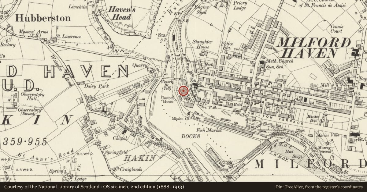
Slide toward Today to fade the historical sheet and see the modern map underneath.
David Rumsey Map Collection, Stanford LibrariesDavid Rumsey Map Collection, Stanford LibrariesDavid Rumsey Map Collection, Stanford LibrariesDavid Rumsey Map Collection, Stanford LibrariesDavid Rumsey Map Collection, Stanford Libraries
5 historical maps cover this location, the earliest the 1636 map "Cornubia : Devonia, Somersetus, Dorcestria, Wiltonia, Glocestria ..." (David Rumsey Map Collection, Stanford Libraries).
Historical maps covering this location
- 1636 · Cornubia : Devonia, Somersetus, Dorcestria, Wiltonia, Glocestria ... (David Rumsey Map Collection, Stanford Libraries)
- 1865 · England and Wales. England No. 6. (David Rumsey Map Collection, Stanford Libraries)
- 1898 · 227 Milford (Outline) (David Rumsey Map Collection, Stanford Libraries)
- 1898 · 227 Milford (Hills) (David Rumsey Map Collection, Stanford Libraries)
- 1901 · Sheet 13. (David Rumsey Map Collection, Stanford Libraries)
Cadw's description
Location
Situated at lower end of Victoria Road, opposite Docks entry.
Exterior
Mid C19 warehouse in red rubble stone with two heavy lintel courses in pink granite and grey limestone dressings to openings. Slate roofs. Two-storey three-gable front angled to bend in road, each gable with roundel and each main section of three-windows, the centre slightly set back. Gables once had overhanging bargeboards. N and S end walls have parapets. Centre section has ground floor altered for broad modern entry, first floor 4-pane sash each side of broad depressed-arched loading door, ground floor originally matched those each side. Side sections each have window, door, window to ground floor and three 4-pane sashes above. The two big granite string courses run at lintel height each floor. South end wall is architecturally treated with castellated parapet, one red brick stack and centre superimposed broad doors, the upper one with depressed arched head. One-window range each side, but granite strings only returned as far as nearest windows.
Reason for designation
Visible in l890 F Frith photograph.
Group value with The Sewin Restaurant building and former Customs House in The Docks.
Nearby in the register
- The Sewin RestaurantCommercialunder 1 mi
- Waterfront Bistro (formerly listed as Milford Docks Company Offices)Maritimeunder 1 mi
- The Customs HouseCivilunder 1 mi
- The George IV MemorialCommemorativeunder 1 mi
Other entries of the same register within about three miles of this one, by straight line.