Cof Cymru: National Historic Assets of Wales · Wales
Crane on S.Side of Marina Basin
Milford Haven, Pembrokeshire, Wales
A Grade II listed building in The Docks, Milford Haven, Pembrokeshire, designated on 22 February 1993.
The record
- Designation
- Listed building, Grade II
- Broad class
- Maritime
- Date of designation
- 22 February 1993
- Locality
- The Docks
- Community
- Milford Haven
- Unitary authority
- Pembrokeshire
- Country
- Wales
- Coordinates
- 51.71028, -5.03688
- Cadw reference
- 12829
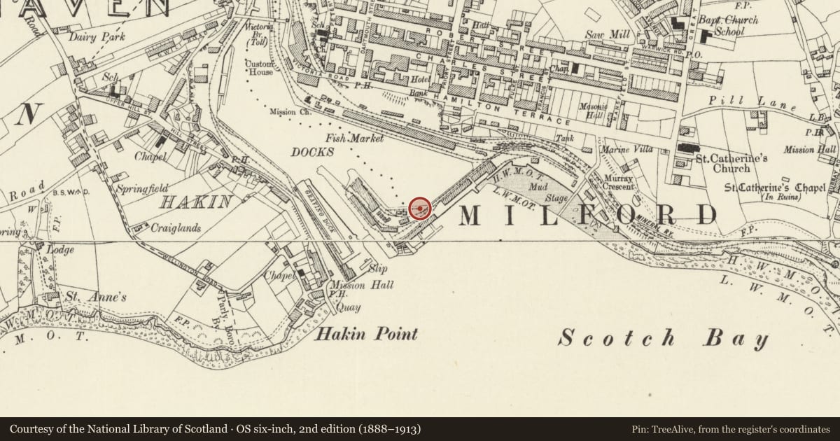
Slide toward Today to fade the historical sheet and see the modern map underneath.
David Rumsey Map Collection, Stanford LibrariesDavid Rumsey Map Collection, Stanford LibrariesDavid Rumsey Map Collection, Stanford LibrariesDavid Rumsey Map Collection, Stanford LibrariesDavid Rumsey Map Collection, Stanford Libraries
5 historical maps cover this location, the earliest the 1636 map "Cornubia : Devonia, Somersetus, Dorcestria, Wiltonia, Glocestria ..." (David Rumsey Map Collection, Stanford Libraries).
Historical maps covering this location
- 1636 · Cornubia : Devonia, Somersetus, Dorcestria, Wiltonia, Glocestria ... (David Rumsey Map Collection, Stanford Libraries)
- 1865 · England and Wales. England No. 6. (David Rumsey Map Collection, Stanford Libraries)
- 1898 · 227 Milford (Outline) (David Rumsey Map Collection, Stanford Libraries)
- 1898 · 227 Milford (Hills) (David Rumsey Map Collection, Stanford Libraries)
- 1901 · Sheet 13. (David Rumsey Map Collection, Stanford Libraries)
Cadw's description
Location
Situated on S side of docks, on side of marina basin.
History
Late Cl9 or early C20 dockside crane.
Exterior
Long tubular steel arm with end pulley stayed back to toothed winding wheel. Winch and jib-arm attached to metal upright frame with base-plate fixed to quayside.
Reason for designation
Included as prominent dockside feature.
Group value with listed bollards at marina basin and adjoining docks.
Nearby in the register
- One of a set of four Bollards on S.Side of Marina BasinGardens, Parks and Urban Spacesunder 1 mi
- One of a set of four Bollards on S.Side of Marina BasinGardens, Parks and Urban Spacesunder 1 mi
- One of 28 Bollards Flanking Entrance LockGardens, Parks and Urban Spacesunder 1 mi
- One of 28 Bollards Flanking Entrance LockGardens, Parks and Urban Spacesunder 1 mi
Other entries of the same register within about three miles of this one, by straight line.