Cof Cymru: National Historic Assets of Wales · Wales
Trefach Mill
Nevern, Pembrokeshire, Wales
A Grade II listed building in Trefach, Nevern, Pembrokeshire, designated on 27 October 1992.
The record
- Designation
- Listed building, Grade II
- Broad class
- Industrial
- Date of designation
- 27 October 1992
- Locality
- Trefach
- Community
- Nevern
- Unitary authority
- Pembrokeshire
- Country
- Wales
- Coordinates
- 52.03532, -4.79158
- Cadw reference
- 12807
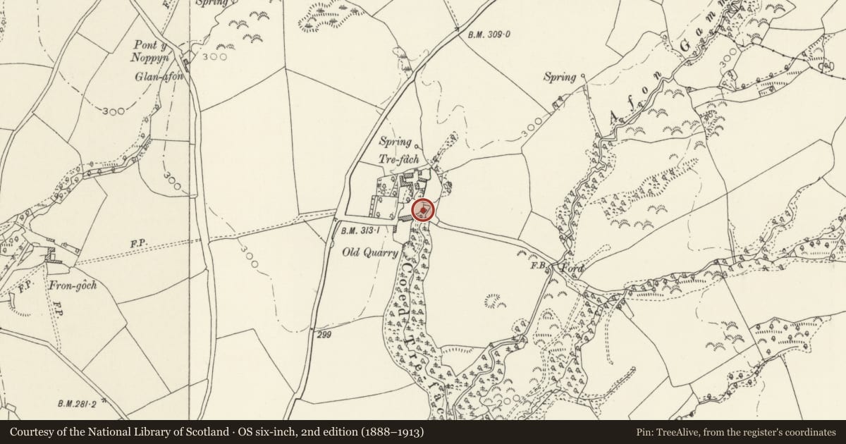
Slide toward Today to fade the historical sheet and see the modern map underneath.
David Rumsey Map Collection, Stanford LibrariesDavid Rumsey Map Collection, Stanford LibrariesDavid Rumsey Map Collection, Stanford LibrariesDavid Rumsey Map Collection, Stanford LibrariesDavid Rumsey Map Collection, Stanford Libraries
5 historical maps cover this location, the earliest the 1608 map "(13) Cambriae Typus." (David Rumsey Map Collection, Stanford Libraries).
Historical maps covering this location
- 1608 · (13) Cambriae Typus. (David Rumsey Map Collection, Stanford Libraries)
- 1636 · Cornubia : Devonia, Somersetus, Dorcestria, Wiltonia, Glocestria ... (David Rumsey Map Collection, Stanford Libraries)
- 1891 · Sheet 10. Ordnance Survey of England and Wales. . (David Rumsey Map Collection, Stanford Libraries)
- 1898 · 193 Cardigan (Hills) (David Rumsey Map Collection, Stanford Libraries)
- 1901 · Sheet 13. (David Rumsey Map Collection, Stanford Libraries)
Cadw's description
Location
Situated SSE of farmhouse on W bank of step gully.
History
Early C19 mill.
Exterior
Rubble stone with slate roof, square plan with roof hipped at NE angle. Single storey to front, dropping steeply to rear where there is basement ground floor and loft. W front has elliptical arched cart entry to right with cut stone voussoirs. Roof hip to left and N side has door and window above. E front, to stream, has gable to right with loft window in centre, then, set to left, large elliptical arched doorway with timber sill and vertical groove running down to arched basement doorway to wheelpit. Hub of iron overshot wheel. To left of gable is long pent roof to mid-height of adjoining elliptical-arched doorway. Buttressed wall and one opening to left of buttress.
South end has one basement opening and one window.
Interior
Deeply sunk E side, loft floor in NE gable, 5-bay collar-truss roof to W range and three-bay roof to gable. Remnant of machinery. Derelict condition but renovation for domestic use proposed 1992.
Reason for designation
A rare surviving example of an early C19 mill building with some machinery in Dyfed.
Nearby in the register
- Trefach, including attached wing to the rightDomesticunder 1 mi
- Tre-Fach CampPromontory Fort - inlandunder 1 mi
- Castell NanhyferMotte and Baileyunder 1 mi
- Church of St BrynarchReligious, Ritual and Funeraryunder 1 mi
Other entries of the same register within about three miles of this one, by straight line.