Cof Cymru: National Historic Assets of Wales · Wales
Tre-Prysg
Nevern, Pembrokeshire, Wales
A Grade II listed building in Moylgrove/Trewyddel, Nevern, Pembrokeshire, designated on 27 October 1992.
The record
- Designation
- Listed building, Grade II
- Broad class
- Domestic
- Date of designation
- 27 October 1992
- Locality
- Moylgrove/Trewyddel
- Community
- Nevern
- Unitary authority
- Pembrokeshire
- Country
- Wales
- Coordinates
- 52.06400, -4.74477
- Cadw reference
- 12798
Slide toward Today to fade the historical sheet and see the modern map underneath.
David Rumsey Map Collection, Stanford LibrariesDavid Rumsey Map Collection, Stanford LibrariesDavid Rumsey Map Collection, Stanford LibrariesDavid Rumsey Map Collection, Stanford LibrariesDavid Rumsey Map Collection, Stanford Libraries
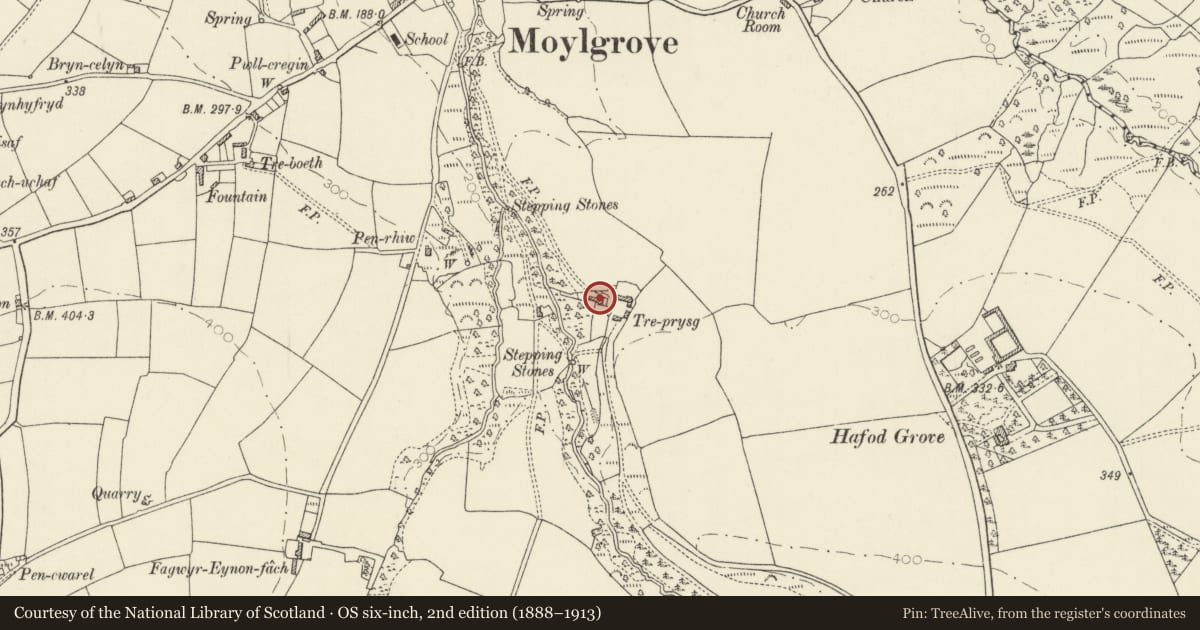
5 historical maps cover this location, the earliest the 1608 map "(13) Cambriae Typus." (David Rumsey Map Collection, Stanford Libraries).
Historical maps covering this location
- 1608 · (13) Cambriae Typus. (David Rumsey Map Collection, Stanford Libraries)
- 1636 · Cornubia : Devonia, Somersetus, Dorcestria, Wiltonia, Glocestria ... (David Rumsey Map Collection, Stanford Libraries)
- 1637 · Particular description of Wales. Cambria seu Wallia (David Rumsey Map Collection, Stanford Libraries)
- 1898 · 193 Cardigan (Hills) (David Rumsey Map Collection, Stanford Libraries)
- 1901 · Sheet 13. (David Rumsey Map Collection, Stanford Libraries)
Cadw's description
Location
Situated some 0.5 km S of Moylgrove up Cwm Bach valley, but approached via drive of some 1 km running N off lane on hilltop about 1 km S of Moylgrove church.
Exterior
Early to mid C18 house in colourwashed rubble stone with slate roof and stone end stacks. Two-storey tall five-window front originally of long 12-pane sashes, since replaced in plastic. Upper floor has no window in left position, nor sign of any blocked in. Centre C20 plastic door and overlight. Timber lintels and slate sills, timber lintel continuous over the four upper windows. Three lower windows have slightly projecting split stone shelves over. End wall to W has one window each floor and one to attic. Rear gable. Roof has slate gable coping and shoulders.
Interior
Front hall is fully panelled with fielded panelling and cornice, three bolection-moulded doorcases with 2-panel doors.
Reason for designation
A very rare surviving example of C18 gentry house with panelling therefore, included despite the modern window and door alterations.
Nearby in the register
- Plas y MwswmDomesticunder 1 mi
- Church CottageDomesticunder 1 mi
- Church of St AndrewReligious, Ritual and Funeraryunder 1 mi
- Penrallt yr Esgob CairnRound Cairnunder 1 mi
Other entries of the same register within about three miles of this one, by straight line.