Cof Cymru: National Historic Assets of Wales · Wales
Cottage to N.of Pantywylan
Nevern, Pembrokeshire, Wales
A Grade II listed building in Moylgrove/Trewyddel, Nevern, Pembrokeshire, designated on 27 October 1992.
The record
- Designation
- Listed building, Grade II
- Broad class
- Domestic
- Date of designation
- 27 October 1992
- Locality
- Moylgrove/Trewyddel
- Community
- Nevern
- Unitary authority
- Pembrokeshire
- Country
- Wales
- Coordinates
- 52.07466, -4.76196
- Cadw reference
- 12797
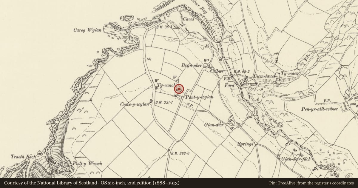
Slide toward Today to fade the historical sheet and see the modern map underneath.
David Rumsey Map Collection, Stanford LibrariesDavid Rumsey Map Collection, Stanford LibrariesDavid Rumsey Map Collection, Stanford LibrariesDavid Rumsey Map Collection, Stanford LibrariesDavid Rumsey Map Collection, Stanford Libraries
5 historical maps cover this location, the earliest the 1608 map "(13) Cambriae Typus." (David Rumsey Map Collection, Stanford Libraries).
Historical maps covering this location
- 1608 · (13) Cambriae Typus. (David Rumsey Map Collection, Stanford Libraries)
- 1636 · Cornubia : Devonia, Somersetus, Dorcestria, Wiltonia, Glocestria ... (David Rumsey Map Collection, Stanford Libraries)
- 1637 · Particular description of Wales. Cambria seu Wallia (David Rumsey Map Collection, Stanford Libraries)
- 1898 · 193 Cardigan (Hills) (David Rumsey Map Collection, Stanford Libraries)
- 1901 · Sheet 13. (David Rumsey Map Collection, Stanford Libraries)
Cadw's description
Location
Situated some 30m N of present farmhouse on hillside S of Ceibwr Bay, approached by drive running N off coastal lane some 800m from Ceibwr.
Exterior
Early to mid C19 single-storey rubble stone cottage in (originally colourwashed) with grouted slate roof and end stone stacks, larger to W end. Offset front elevation of 4-pane sash each side of plank door, red brick cambered heads. Whitewashed W end wall and outshut rear.
E is lower outbuilding with whitewashed front, door, window, door and window; asbestos roof.
Interior
4-bay collar truss roof and timber-lintel W end fireplace. Attached to
Reason for designation
A rare surviving unaltered single-storey farmhouse, once common in the area.
Nearby in the register
- Pen-Castell Promontory FortEnclosure - Defensiveunder 1 mi
- Castell Tre-RiffithPromontory Fort - coastalunder 1 mi
- Plas y MwswmDomesticunder 1 mi
- Penrallt yr Esgob CairnRound Cairnunder 1 mi
Other entries of the same register within about three miles of this one, by straight line.