Cof Cymru: National Historic Assets of Wales · Wales
Ffynnonddofn Morfa
Nevern, Pembrokeshire, Wales
A Grade II listed building in Nevern, Pembrokeshire, designated on 27 October 1992.
The record
- Designation
- Listed building, Grade II
- Broad class
- Domestic
- Date of designation
- 27 October 1992
- Community
- Nevern
- Unitary authority
- Pembrokeshire
- Country
- Wales
- Coordinates
- 52.03770, -4.83020
- Cadw reference
- 12793
Slide toward Today to fade the historical sheet and see the modern map underneath.
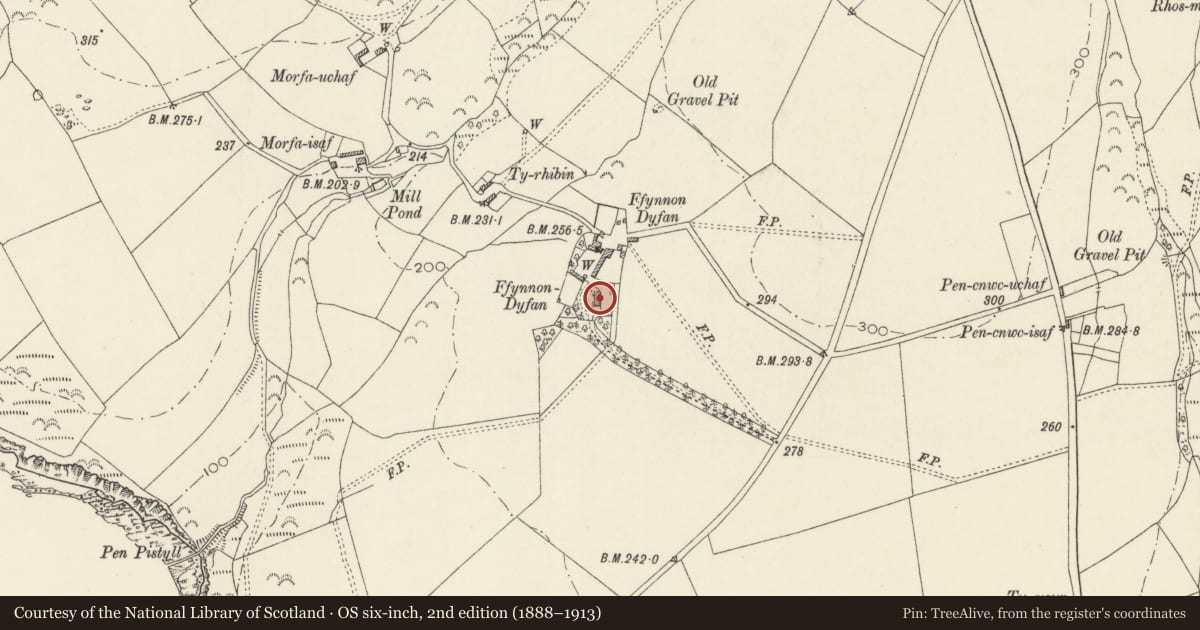
David Rumsey Map Collection, Stanford LibrariesDavid Rumsey Map Collection, Stanford LibrariesDavid Rumsey Map Collection, Stanford LibrariesDavid Rumsey Map Collection, Stanford LibrariesDavid Rumsey Map Collection, Stanford Libraries
5 historical maps cover this location, the earliest the 1608 map "(13) Cambriae Typus." (David Rumsey Map Collection, Stanford Libraries).
Historical maps covering this location
- 1608 · (13) Cambriae Typus. (David Rumsey Map Collection, Stanford Libraries)
- 1636 · Cornubia : Devonia, Somersetus, Dorcestria, Wiltonia, Glocestria ... (David Rumsey Map Collection, Stanford Libraries)
- 1891 · Sheet 10. Ordnance Survey of England and Wales. . (David Rumsey Map Collection, Stanford Libraries)
- 1898 · 193 Cardigan (Hills) (David Rumsey Map Collection, Stanford Libraries)
- 1901 · Sheet 13. (David Rumsey Map Collection, Stanford Libraries)
Cadw's description
Location
Situated off lane to Morfa some 0.5 km WNW of junction with road to Newport Sands, the junction some 1.1 km NE of beach.
Exterior
Dated 1781 on inglenook beam, small country house in coursed stone with slate roof and stone end wall stacks. Regular two-storey three-window front of 4-pane sashes with slate sills and recessed voussoirs with keystones. Centre broad pediment with tripartite small-paned attic lunette. Eaves and gable have been simplified in C20. Centre 6-panel door with fielded panels and traceried overlight. Similar voussoirs and keystone. 2 x C20 dormers. Rear has centre stair gable with small sash in gable and 12-pane stair-light, 9-pane sash to first floor right and 4-pane sash below.
Modernised service range, rebuilt in 1930s, with two-window range of 4-pane sashes to roughcast front.
Mounting block to N of house.
Reason for designation
Style of house is more typical of c1800-20. Shown on 1843 Tithe Map as owned by Mary Griffiths.
A good example of a small classical country house of regional type.
Nearby in the register
- Outbuilding to N.of Ffynnonddofn MorfaDomesticunder 1 mi
- Stable Building at Berry Hill FarmDomesticunder 1 mi
- Coach House at Berry Hill FarmDomesticunder 1 mi
- Berry Hill FarmhouseDomesticunder 1 mi
Other entries of the same register within about three miles of this one, by straight line.