Cof Cymru: National Historic Assets of Wales · Wales
Pantsaeson Farmhouse
Nevern, Pembrokeshire, Wales
A Grade II listed building in Monington/Eglwys Wythwr, Nevern, Pembrokeshire, designated on 27 October 1992.
The record
- Designation
- Listed building, Grade II
- Broad class
- Domestic
- Date of designation
- 27 October 1992
- Locality
- Monington/Eglwys Wythwr
- Community
- Nevern
- Unitary authority
- Pembrokeshire
- Country
- Wales
- Coordinates
- 52.07193, -4.72543
- Cadw reference
- 12786
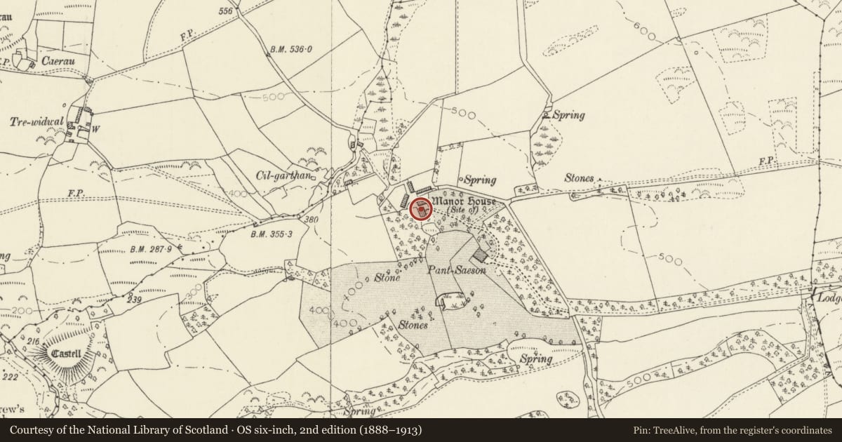
Slide toward Today to fade the historical sheet and see the modern map underneath.
David Rumsey Map Collection, Stanford LibrariesDavid Rumsey Map Collection, Stanford LibrariesDavid Rumsey Map Collection, Stanford LibrariesDavid Rumsey Map Collection, Stanford LibrariesDavid Rumsey Map Collection, Stanford Libraries
5 historical maps cover this location, the earliest the 1608 map "(13) Cambriae Typus." (David Rumsey Map Collection, Stanford Libraries).
Historical maps covering this location
- 1608 · (13) Cambriae Typus. (David Rumsey Map Collection, Stanford Libraries)
- 1636 · Cornubia : Devonia, Somersetus, Dorcestria, Wiltonia, Glocestria ... (David Rumsey Map Collection, Stanford Libraries)
- 1637 · Particular description of Wales. Cambria seu Wallia (David Rumsey Map Collection, Stanford Libraries)
- 1898 · 193 Cardigan (Hills) (David Rumsey Map Collection, Stanford Libraries)
- 1901 · Sheet 13. (David Rumsey Map Collection, Stanford Libraries)
Cadw's description
Location
Situated some 150m N of Plas Pantsaeson, approached by long drive of some 800m from minor lane at Waunwhiod 2km W of St Dogmaels.
Exterior
C18 and C19 estate farmhouse in rubble stone, roughcast to front, with asbestos roof, stone ridge stack and E end stack to rear wing. Two-storey four-window front with long 9-pane sashes above and long 12-pane sashes below, except French window in right end opening. Roof is hipped at NW angle. House was divided and given two arched stair lights, the one in main rear wall to left has been removed and reinstated in N front of rear wing, where an arch in adjoining stonework indicates position of a previous stair light. Wing has 9-pane sash each side of stair light, off-centre door below with 12-pane sash to left and 16-pane window to right. Windows mostly renewed. Rear of wing is outshut.
In front wall, next to second ground floor window is small plaque "WIM 1752", for W. and M.James, that is probably reset from an earlier building; this may indicate C18 origins for a building which in character is otherwise earlier C19.
Nearby in the register
- Coach House and Stable at Pantsaeson FarmDomesticunder 1 mi
- Outside Kitchen at Pantsaeson FarmDomesticunder 1 mi
- Barn at Pantsaeson FarmAgriculture and Subsistenceunder 1 mi
- One of two ranges of linked Outbuildings at Pantsaeson FarmAgriculture and Subsistenceunder 1 mi
Other entries of the same register within about three miles of this one, by straight line.