Cof Cymru: National Historic Assets of Wales · Wales
Wenallt
Nevern, Pembrokeshire, Wales
A Grade II listed building in Nevern, Pembrokeshire, designated on 27 October 1992.
The record
- Designation
- Listed building, Grade II
- Broad class
- Domestic
- Date of designation
- 27 October 1992
- Community
- Nevern
- Unitary authority
- Pembrokeshire
- Country
- Wales
- Coordinates
- 52.01369, -4.76202
- Cadw reference
- 12765
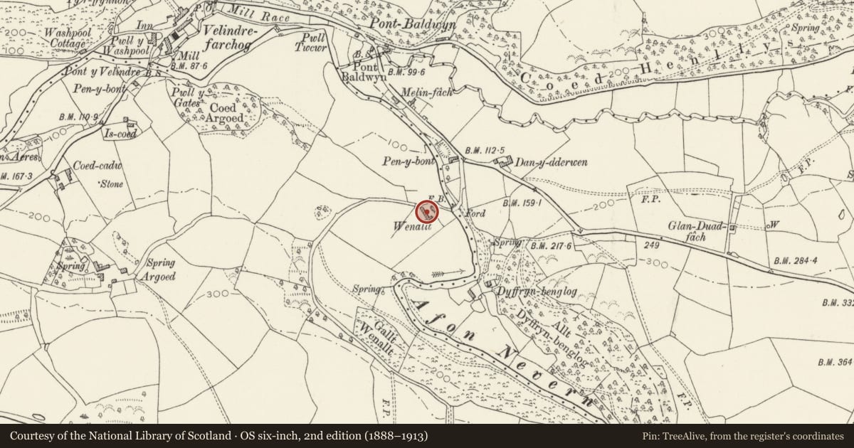
Slide toward Today to fade the historical sheet and see the modern map underneath.
David Rumsey Map Collection, Stanford LibrariesDavid Rumsey Map Collection, Stanford LibrariesDavid Rumsey Map Collection, Stanford LibrariesDavid Rumsey Map Collection, Stanford LibrariesDavid Rumsey Map Collection, Stanford Libraries
5 historical maps cover this location, the earliest the 1636 map "Cornubia : Devonia, Somersetus, Dorcestria, Wiltonia, Glocestria ..." (David Rumsey Map Collection, Stanford Libraries).
Historical maps covering this location
- 1636 · Cornubia : Devonia, Somersetus, Dorcestria, Wiltonia, Glocestria ... (David Rumsey Map Collection, Stanford Libraries)
- 1891 · Sheet 10. Ordnance Survey of England and Wales. . (David Rumsey Map Collection, Stanford Libraries)
- 1898 · 210 Cardigan (Hills) (David Rumsey Map Collection, Stanford Libraries)
- 1898 · 210 Cardigan (Outline) (David Rumsey Map Collection, Stanford Libraries)
- 1901 · Sheet 13. (David Rumsey Map Collection, Stanford Libraries)
Cadw's description
Location
Situated on S side of Afon Nyfer, approached by track from Penybont some 600m E of Felindre Farchog.
Exterior
Mid C19 farmhouse in coursed rubble stone with slate roof and stone end stacks. Two-storey three-window range, L-plan, the front regular with 12-pane sashes, slate sills and cut stone voussoirs. 6-panel fielded door. Whitewashed end wall.
Rear wing with 12-pane stair light in angle, door and then 12-pane sash each floor, not aligned.
Front garden enclosed by curving rubble stone front wall with white quartz capping.
Reason for designation
Included as good regional example of C19 farmhouse in traditional style.
Nearby in the register
- CollegeEducationunder 1 mi
- Cana Chapel/Capel Cana including forecourt walls, railings and gatesReligious, Ritual and Funeraryunder 1 mi
- The PoundDomesticunder 1 mi
- PendreDomesticunder 1 mi
Other entries of the same register within about three miles of this one, by straight line.