Cof Cymru: National Historic Assets of Wales · Wales
Outbuilding to N. of Treginnis Isaf Farmhouse
St. David's and the Cathedral Close, Pembrokeshire, Wales
A Grade II listed building in Treginnis, St. David's and the Cathedral Close, Pembrokeshire, designated on 28 July 1992.
The record
- Designation
- Listed building, Grade II
- Broad class
- Agriculture and Subsistence
- Date of designation
- 28 July 1992
- Locality
- Treginnis
- Community
- St. David's and the Cathedral Close
- Unitary authority
- Pembrokeshire
- Country
- Wales
- Coordinates
- 51.86818, -5.30712
- Cadw reference
- 12721
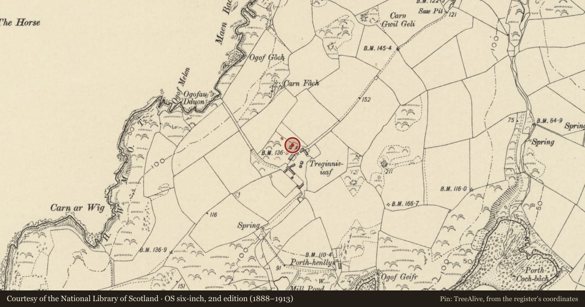
Slide toward Today to fade the historical sheet and see the modern map underneath.
David Rumsey Map Collection, Stanford LibrariesDavid Rumsey Map Collection, Stanford LibrariesDavid Rumsey Map Collection, Stanford LibrariesDavid Rumsey Map Collection, Stanford LibrariesDavid Rumsey Map Collection, Stanford Libraries
5 historical maps cover this location, the earliest the 1608 map "(13) Cambriae Typus." (David Rumsey Map Collection, Stanford Libraries).
Historical maps covering this location
- 1608 · (13) Cambriae Typus. (David Rumsey Map Collection, Stanford Libraries)
- 1636 · Cornubia : Devonia, Somersetus, Dorcestria, Wiltonia, Glocestria ... (David Rumsey Map Collection, Stanford Libraries)
- 1637 · Particular description of Wales. Cambria seu Wallia (David Rumsey Map Collection, Stanford Libraries)
- 1898 · 209 St David's (Hills) (David Rumsey Map Collection, Stanford Libraries)
- 1901 · Sheet 13. (David Rumsey Map Collection, Stanford Libraries)
Cadw's description
Exterior
12721
Situated some 20m N of farmhouse, backing onto enclosed yard behind granary/calf house.
Later C19 outbuilding, purpose uncertain, possibly labourer's cottage, though sunk slated floors suggest slaughterhouse. Rubble stone with hipped slate roof and off-centre brick stack. Three-room plan, single storey, with E front door and overlight under timber lintel and two small windows with cambered brick heads. Door at N end. At rear are three lean-to pig-sties to left and small lean-to to right with S end door. At N end is older roofless gabled privy. Pig-sties have enclosed areas in front and open onto enclosed yard.
Interior: Three small rooms, slate-flagged, that to N windowless with low wall dividing off sunken floor from rear corridor; centre room with door and window, S room with window and small fireplace.
Included for group value.
Reference: National Trust Archaeological Survey: Treginnis and Porthclais, 1989.
Nearby in the register
- Granary & Cowhouse to NE. of Treginnis Isaf FarmhouseAgriculture and Subsistenceunder 1 mi
- Treginnis Isaf/Lower TreginnisDomesticunder 1 mi
- Cowhouse & Loft to E of Treginnis FarmhouseAgriculture and Subsistenceunder 1 mi
- Dovecote at Treginnis Isaf FarmDomesticunder 1 mi
Other entries of the same register within about three miles of this one, by straight line.