Cof Cymru: National Historic Assets of Wales · Wales
Rhodiad Chapel
St. David's and the Cathedral Close, Pembrokeshire, Wales
A Grade II listed building in St. David's and the Cathedral Close, Pembrokeshire, designated on 1 March 1963.
The record
- Designation
- Listed building, Grade II
- Broad class
- Religious, Ritual and Funerary
- Date of designation
- 1 March 1963
- Community
- St. David's and the Cathedral Close
- Unitary authority
- Pembrokeshire
- Country
- Wales
- Coordinates
- 51.89909, -5.24691
- Cadw reference
- 12702
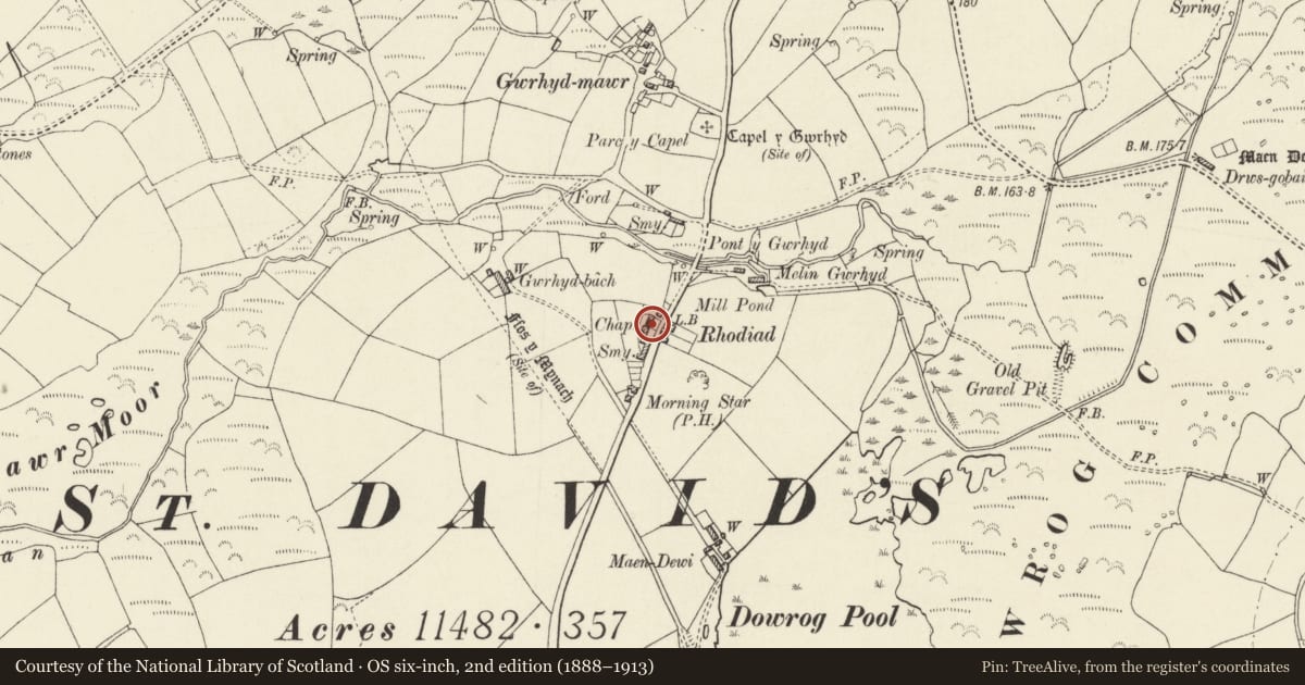
Slide toward Today to fade the historical sheet and see the modern map underneath.
David Rumsey Map Collection, Stanford LibrariesDavid Rumsey Map Collection, Stanford LibrariesDavid Rumsey Map Collection, Stanford LibrariesDavid Rumsey Map Collection, Stanford LibrariesDavid Rumsey Map Collection, Stanford Libraries
5 historical maps cover this location, the earliest the 1608 map "(13) Cambriae Typus." (David Rumsey Map Collection, Stanford Libraries).
Historical maps covering this location
- 1608 · (13) Cambriae Typus. (David Rumsey Map Collection, Stanford Libraries)
- 1636 · Cornubia : Devonia, Somersetus, Dorcestria, Wiltonia, Glocestria ... (David Rumsey Map Collection, Stanford Libraries)
- 1637 · Particular description of Wales. Cambria seu Wallia (David Rumsey Map Collection, Stanford Libraries)
- 1898 · 209 St David's (Hills) (David Rumsey Map Collection, Stanford Libraries)
- 1901 · Sheet 13. (David Rumsey Map Collection, Stanford Libraries)
Cadw's description
Location
Situated in the hamlet of Rhodiad, on western side of road, set back.
History
1784, altered 1884.
Exterior
Congregational chapel in rubble stone with colourwashed lateral facade and grouted slate roof. Nogged brick eaves. Informal four-window front with three 12-pane sashes, the outer sashes set low, that to left of centre slightly higher and double doors to right of centre set in hipped grouted-slate roofed porch with substantial rubble stone sides. Plaque above: 'Yr Adeilad hon a sylfaenwyd 14eg Fehn 1784 Agorwyd yn lle o addoliad ar y 19eg o Ionr 1785 ac a alwyd Rhodiad y Brenhin. Adnewyddwyd ac ail agorwyd Mehn 17 ar 18 1884.'
Chapel forecourt: enclosed by rubble wall with two gate piers and wooden gates.
Interior
Apparently of 1884 with plain later C19 pews facing end dais and later C19 7-bay collar-truss roof with kingposts and angle struts. One 12-pane sash on rear wall.
Reason for designation
A rare surviving example of small rural chapel of C18.
Nearby in the register
- Village Pump, including Walled EnclosureDomesticunder 1 mi
- Pont y GwrhydTransportunder 1 mi
- Gwrhyd Bach, including attached OutbuildingsDomesticunder 1 mi
- Maen DewiDomesticunder 1 mi
Other entries of the same register within about three miles of this one, by straight line.