Cof Cymru: National Historic Assets of Wales · Wales
Cartshed & attached Pigsties at Llanfryn-Y-Fran
St. David's and the Cathedral Close, Pembrokeshire, Wales
A Grade II listed building in Llanfyrn/Llanvirn, St. David's and the Cathedral Close, Pembrokeshire, designated on 28 July 1992.
The record
- Designation
- Listed building, Grade II
- Broad class
- Agriculture and Subsistence
- Date of designation
- 28 July 1992
- Locality
- Llanfyrn/Llanvirn
- Community
- St. David's and the Cathedral Close
- Unitary authority
- Pembrokeshire
- Country
- Wales
- Coordinates
- 51.92929, -5.20195
- Cadw reference
- 12673
Slide toward Today to fade the historical sheet and see the modern map underneath.
David Rumsey Map Collection, Stanford LibrariesDavid Rumsey Map Collection, Stanford LibrariesDavid Rumsey Map Collection, Stanford LibrariesDavid Rumsey Map Collection, Stanford LibrariesDavid Rumsey Map Collection, Stanford Libraries
5 historical maps cover this location, the earliest the 1608 map "(13) Cambriae Typus." (David Rumsey Map Collection, Stanford Libraries).
Historical maps covering this location
- 1608 · (13) Cambriae Typus. (David Rumsey Map Collection, Stanford Libraries)
- 1636 · Cornubia : Devonia, Somersetus, Dorcestria, Wiltonia, Glocestria ... (David Rumsey Map Collection, Stanford Libraries)
- 1637 · Particular description of Wales. Cambria seu Wallia (David Rumsey Map Collection, Stanford Libraries)
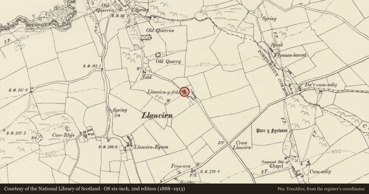
- 1898 · 209 St David's (Hills) (David Rumsey Map Collection, Stanford Libraries)
- 1901 · Sheet 13. (David Rumsey Map Collection, Stanford Libraries)
Cadw's description
Location
Situated down drive of approx 300m running N from Llanrhian road at Croes Llanfyrn, some 400m E of Berea Chapel.
Exterior
Early C19 cartshed and pigsties. Rubble stone cartshed with grouted slate roof and end wall cut-stone elliptical arched cart-entry with keystone. Four tiers of brick doveholes with stone shelves in gable. Four bay roof.
Attached to N is low-walled rounded enclosure for pig-sty and then very unusual pair of low pig-sties in rubble stone with thin stone slab roofing and similar thin stone used internally for corbelled roofs. First pig-sty has two small openings into enclosure against cartshed, second has low door to front but no enclosure.
Such roofing is exceptional in the area and probably localised to the area of Llanvirn shales that laminate effectively. In the bank opposite are two similarly constructed goose-shelters, rubble stone fronted with low entries and chambers within some 1m by 2m.
Reason for designation
An exceptionally fine group of smaller agricultural buildings.
Nearby in the register
- Outbuilding at S.End of range at Llanfyrn-y-FranAgriculture and Subsistenceunder 1 mi
- The CwmDomesticunder 1 mi
- Melin AbereiddyIndustrialunder 1 mi
- Range of Outbuilding along roadside at Porthiddy FarmhouseAgriculture and Subsistenceunder 1 mi
Other entries of the same register within about three miles of this one, by straight line.