Cof Cymru: National Historic Assets of Wales · Wales
Hendy Gwyn
St. David's and the Cathedral Close, Pembrokeshire, Wales
A Grade II listed building in St. David's and the Cathedral Close, Pembrokeshire, designated on 26 August 1981.
The record
- Designation
- Listed building, Grade II
- Broad class
- Domestic
- Date of designation
- 26 August 1981
- Community
- St. David's and the Cathedral Close
- Unitary authority
- Pembrokeshire
- Country
- Wales
- Coordinates
- 51.88163, -5.26548
- Cadw reference
- 12627
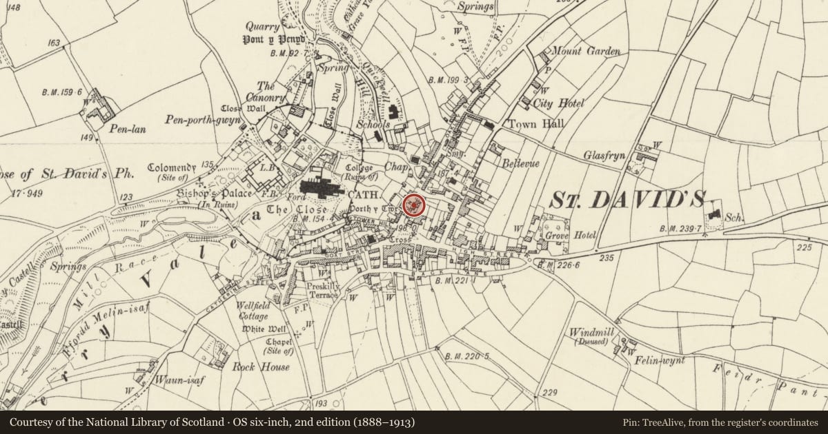
Slide toward Today to fade the historical sheet and see the modern map underneath.
David Rumsey Map Collection, Stanford LibrariesDavid Rumsey Map Collection, Stanford LibrariesDavid Rumsey Map Collection, Stanford LibrariesDavid Rumsey Map Collection, Stanford LibrariesDavid Rumsey Map Collection, Stanford Libraries
5 historical maps cover this location, the earliest the 1608 map "(13) Cambriae Typus." (David Rumsey Map Collection, Stanford Libraries).
Historical maps covering this location
- 1608 · (13) Cambriae Typus. (David Rumsey Map Collection, Stanford Libraries)
- 1636 · Cornubia : Devonia, Somersetus, Dorcestria, Wiltonia, Glocestria ... (David Rumsey Map Collection, Stanford Libraries)
- 1637 · Particular description of Wales. Cambria seu Wallia (David Rumsey Map Collection, Stanford Libraries)
- 1898 · 209 St David's (Hills) (David Rumsey Map Collection, Stanford Libraries)
- 1901 · Sheet 13. (David Rumsey Map Collection, Stanford Libraries)
Cadw's description
Location
Situated near S end of street, set back in gap between Nos 12 and 16; opposite Cathedral Villas.
Exterior
Mid C19 house with painted stucco front, imitation slate roof (grouted slate 1981) and stone end stacks, larger to left. Two storeys, the left side of front partly obscured by No 16, the right corner attached to rear angle of
No 12. Four narrow windows above with pebbledashed keyblocks and C20 aluminium windows; ground floor door under second window with original large 12-pane sash to left and right. Similar key blocks to ground floor.
Front garden: enclosed by low coped rubble wall with ornamental cast-iron arcaded railing, mid to later C19, and matching gate.
Reason for designation
Not marked on 1840 Tithe Map.
Group value.
Nearby in the register
- 12 Nun StreetDomesticunder 1 mi
- 10 Nun StreetDomesticunder 1 mi
- 8 Nun StreetDomesticunder 1 mi
- No.3 Cathedral VillasDomesticunder 1 mi
Other entries of the same register within about three miles of this one, by straight line.