Cof Cymru: National Historic Assets of Wales · Wales
17 Goat Street
St. David's and the Cathedral Close, Pembrokeshire, Wales
A Grade II listed building in St. David's and the Cathedral Close, Pembrokeshire, designated on 26 August 1981.
The record
- Designation
- Listed building, Grade II
- Broad class
- Domestic
- Date of designation
- 26 August 1981
- Community
- St. David's and the Cathedral Close
- Unitary authority
- Pembrokeshire
- Country
- Wales
- Coordinates
- 51.88066, -5.26754
- Cadw reference
- 12603
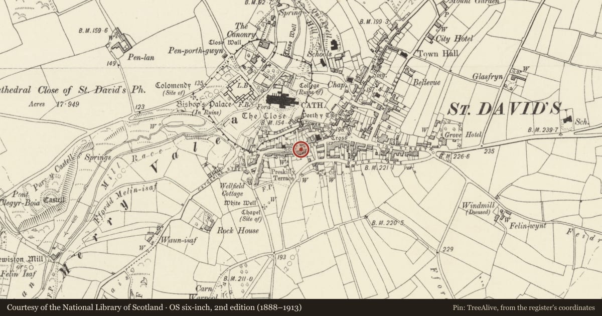
Slide toward Today to fade the historical sheet and see the modern map underneath.
David Rumsey Map Collection, Stanford LibrariesDavid Rumsey Map Collection, Stanford LibrariesDavid Rumsey Map Collection, Stanford LibrariesDavid Rumsey Map Collection, Stanford LibrariesDavid Rumsey Map Collection, Stanford Libraries
5 historical maps cover this location, the earliest the 1608 map "(13) Cambriae Typus." (David Rumsey Map Collection, Stanford Libraries).
Historical maps covering this location
- 1608 · (13) Cambriae Typus. (David Rumsey Map Collection, Stanford Libraries)
- 1636 · Cornubia : Devonia, Somersetus, Dorcestria, Wiltonia, Glocestria ... (David Rumsey Map Collection, Stanford Libraries)
- 1637 · Particular description of Wales. Cambria seu Wallia (David Rumsey Map Collection, Stanford Libraries)
- 1898 · 209 St David's (Hills) (David Rumsey Map Collection, Stanford Libraries)
- 1901 · Sheet 13. (David Rumsey Map Collection, Stanford Libraries)
Cadw's description
Location
Pair of houses in terraced row on south side, opposite Farmers Arms PH.
History
Mid C19 symmetrical pair of houses faced in squared purple Caerbwdy stone with slate roof and brick and stacks.
Exterior
Two storeys, two windows to each house; 12-pane sashes to No 17, replaced since 1981 in plastic on No 15, the inner windows of each house set close together over paired doors. 4-panel doors with traceried overlights. Slightly cambered Caerbwdy stone heads to windows, flat heads, to doors. Slate sills. Basement windows at pavement level and double flight of stone-fronted steps with iron spearhead railings up to front doors.
Reason for designation
Not marked on 1840 Tithe Map.
A rare example of the use of purple Caerbwdy stone for a full facade.
Nearby in the register
- 15 Goat StreetDomesticunder 1 mi
- 27 Goat StreetDomesticunder 1 mi
- 7 Goat StreetDomesticunder 1 mi
- 33 Goat StreetDomesticunder 1 mi
Other entries of the same register within about three miles of this one, by straight line.