Cof Cymru: National Historic Assets of Wales · Wales
Warehouse adjoining No.22 Catherine Street
St. David's and the Cathedral Close, Pembrokeshire, Wales
A Grade II listed building in St. David's and the Cathedral Close, Pembrokeshire, designated on 26 August 1981.
The record
- Designation
- Listed building, Grade II
- Broad class
- Commercial
- Date of designation
- 26 August 1981
- Community
- St. David's and the Cathedral Close
- Unitary authority
- Pembrokeshire
- Country
- Wales
- Coordinates
- 51.88002, -5.27130
- Cadw reference
- 12574
Slide toward Today to fade the historical sheet and see the modern map underneath.
David Rumsey Map Collection, Stanford LibrariesDavid Rumsey Map Collection, Stanford LibrariesDavid Rumsey Map Collection, Stanford LibrariesDavid Rumsey Map Collection, Stanford LibrariesDavid Rumsey Map Collection, Stanford Libraries
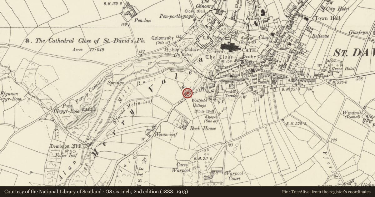
5 historical maps cover this location, the earliest the 1608 map "(13) Cambriae Typus." (David Rumsey Map Collection, Stanford Libraries).
Historical maps covering this location
- 1608 · (13) Cambriae Typus. (David Rumsey Map Collection, Stanford Libraries)
- 1636 · Cornubia : Devonia, Somersetus, Dorcestria, Wiltonia, Glocestria ... (David Rumsey Map Collection, Stanford Libraries)
- 1637 · Particular description of Wales. Cambria seu Wallia (David Rumsey Map Collection, Stanford Libraries)
- 1898 · 209 St David's (Hills) (David Rumsey Map Collection, Stanford Libraries)
- 1901 · Sheet 13. (David Rumsey Map Collection, Stanford Libraries)
Cadw's description
Location
Situated to W of No 22, on N side of street; the first building of the built-up centre of Saint David's on the approach from Porthclais.
History
Later C18 or early C19 warehouse associated with the coastal trade to Porthclais.
Exterior
Large rubble stone three-storey building with grouted slate roof, gable-end to street. Gable end has broad ground floor entry with iron lintel, first floor and second floor loading doors flanked by square windows, doors with concrete lintels, windows with timber lintels. Second floor right window is blocked in red brick as are two small loft lights above.
Side elevations are 4-window with small square windows and timber lintels to first and second floors, mostly glazed, some boarded openings. West side has three ground floor openings. East side has door in first floor left bay, approached by C20 concrete steps and ground floor centre door with two windows to right. SE angle is rounded at ground floor.
Reason for designation
One of three surviving warehouses on the road from the harbour at Porthclais to Saint David's. Marked on 1840 Tithe Map as owned by Elizabeth Williams, owner also of the second storehouse (see Goat Street); in 1864 two storehouses were owned by William Williams and this one was still owned by W Williams of The Grove Hotel in 1890s.
Nearby in the register
- Pont Cerwyn Dewi/Merryvale Bridge & attached TowerTransportunder 1 mi
- Warehouse between Merrivale & No.2 Catherine StreetCommercialunder 1 mi
- The Deanery including Garden Walls & GateDomesticunder 1 mi
- 51 Goat StreetDomesticunder 1 mi
Other entries of the same register within about three miles of this one, by straight line.