Cof Cymru: National Historic Assets of Wales · Wales
Garden Wall to NE.of Treasurer's House
St. David's and the Cathedral Close, Pembrokeshire, Wales
A Grade II listed building in St. David's and the Cathedral Close, Pembrokeshire, designated on 26 August 1981.
The record
- Designation
- Listed building, Grade II
- Broad class
- Domestic
- Date of designation
- 26 August 1981
- Community
- St. David's and the Cathedral Close
- Unitary authority
- Pembrokeshire
- Country
- Wales
- Coordinates
- 51.88289, -5.26864
- Cadw reference
- 12564
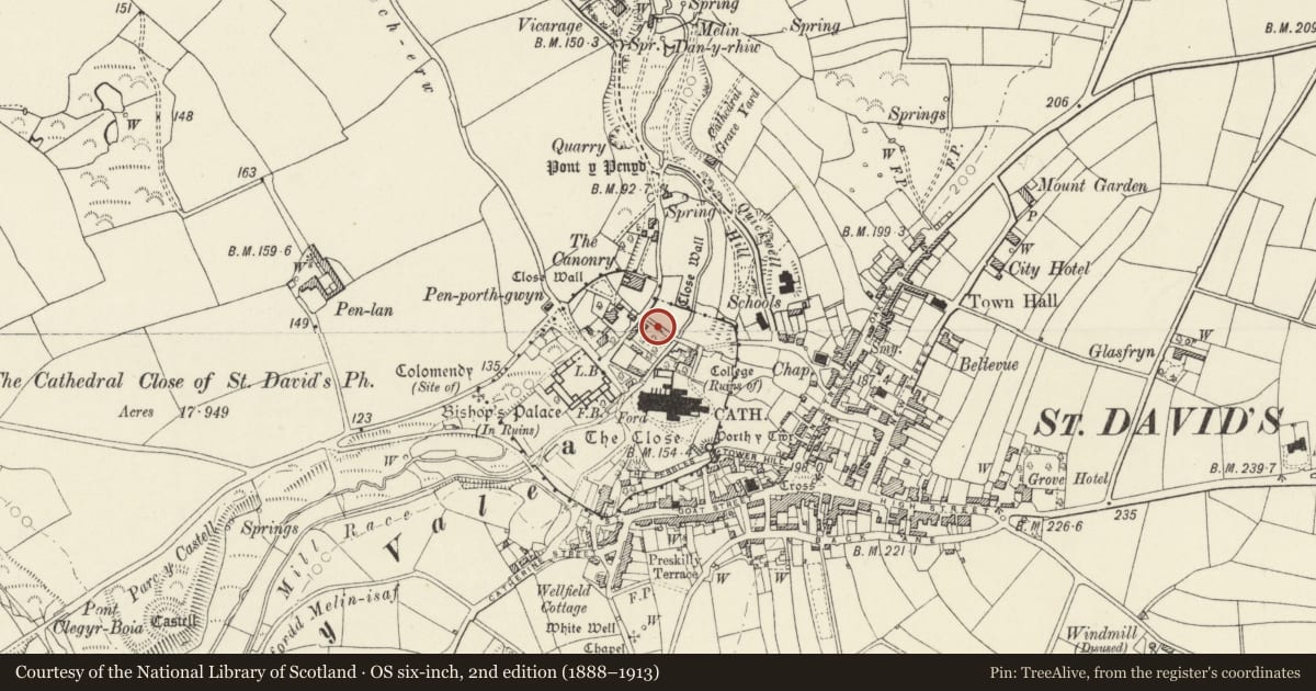
Slide toward Today to fade the historical sheet and see the modern map underneath.
David Rumsey Map Collection, Stanford LibrariesDavid Rumsey Map Collection, Stanford LibrariesDavid Rumsey Map Collection, Stanford LibrariesDavid Rumsey Map Collection, Stanford LibrariesDavid Rumsey Map Collection, Stanford Libraries
5 historical maps cover this location, the earliest the 1608 map "(13) Cambriae Typus." (David Rumsey Map Collection, Stanford Libraries).
Historical maps covering this location
- 1608 · (13) Cambriae Typus. (David Rumsey Map Collection, Stanford Libraries)
- 1636 · Cornubia : Devonia, Somersetus, Dorcestria, Wiltonia, Glocestria ... (David Rumsey Map Collection, Stanford Libraries)
- 1637 · Particular description of Wales. Cambria seu Wallia (David Rumsey Map Collection, Stanford Libraries)
- 1898 · 209 St David's (Hills) (David Rumsey Map Collection, Stanford Libraries)
- 1901 · Sheet 13. (David Rumsey Map Collection, Stanford Libraries)
Cadw's description
Location
Situated on SW side of unmetalled lane leading down to bridge over river and Cloister Hall, and with short return back to Treasurer's House.
History
Uncertain date. Garden wall to NE side of garden of Treasurer's House, running from house to River Alun along lane to Cloister Hall.
Exterior
Rubble stone. Short section of about 8m from house to corner with cambered-arched doorway by house, then splayed NE angle and some 45m length down towards the river, varying in height from about 2m to about 1.5m. By NE angle there is a low (about 1m high) blocked, segmental-arched opening with single stone for head. Possibly C16. In centre of long wall is C19 garden door with brick pointed head.
Garden wall occupies site of rear of medieval Treasurer's house, which was a 3-sided courtyard house open to SW, as shown on Joseph Lord's map of 1720. Marked on 1840 Tithe Map.
Reason for designation
Group value with Treasurer's House and Bridge behind Cloister Hall.
Nearby in the register
- St Davids Cathedral Close: Archdeacon of Cardigans GroundHouse (domestic)under 1 mi
- Bridge to rear of Cloister HallTransportunder 1 mi
- Treasury CottageDomesticunder 1 mi
- Retaining Wall on NE.Side of River Alun between Bridge by Pen-y-Ffos and Bridge behind Cloister HallDomesticunder 1 mi
Other entries of the same register within about three miles of this one, by straight line.